
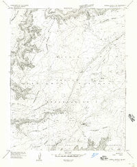
~ Sonsala Butte 3 NE AZ topo map, 1:24000 scale, 7.5 X 7.5 Minute, Historical, 1955, updated 1958
Sonsala Butte 3 NE, Arizona, USGS topographic map dated 1955.
Includes geographic coordinates (latitude and longitude). This topographic map is suitable for hiking, camping, and exploring, or framing it as a wall map.
Printed on-demand using high resolution imagery, on heavy weight and acid free paper, or alternatively on a variety of synthetic materials.
Topos available on paper, Waterproof, Poly, or Tyvek. Usually shipping rolled, unless combined with other folded maps in one order.
- Product Number: USGS-5556010
- Free digital map download (high-resolution, GeoPDF): Sonsala Butte 3 NE, Arizona (file size: 9 MB)
- Map Size: please refer to the dimensions of the GeoPDF map above
- Weight (paper map): ca. 55 grams
- Map Type: POD USGS Topographic Map
- Map Series: HTMC
- Map Verison: Historical
- Cell ID: 31104
- Scan ID: 313445
- Imprint Year: 1958
- Aerial Photo Year: 1953
- Datum: Unstated
- Map Projection: Unstated
- Preliminary map: Yes
- Map published by United States Geological Survey
- Keywords: Nonstandard Press Run
- Map Language: English
- Scanner Resolution: 600 dpi
- Map Cell Name: Black Rock Butte
- Grid size: 7.5 X 7.5 Minute
- Date on map: 1955
- Map Scale: 1:24000
- Geographical region: Arizona, United States
Neighboring Maps:
All neighboring USGS topo maps are available for sale online at a variety of scales.
Spatial coverage:
Topo map Sonsala Butte 3 NE, Arizona, covers the geographical area associated the following places:
- Frozen Feet Windmill - Big Cave Ruins - Black Rock Trail - Yucca Cave Ruins - Garden Dam - Mummy Cave Overlook - Little Middle Mesa - Black Rock Spring - Tseh-Ya-Kin Canyon - Sheep Point - Bear Spring - Ndishchii Naati - Sheep Point Canyon - Spanish Trail - Giant Canyon - Black Rock Butte - Middle Mesa - Sagebrush Dam - Massacre Cave Overlook - Twin Dams - Red Clay Trail - Fir Tree Canyon - Black Wood Hill - Ata Deeza - Poison Ivy Canyon - Peninsula Windmill - Mummy Cave Ruins - White Butte - Big Flow
- Map Area ID: AREA36.2536.125-109.375-109.25
- Northwest corner Lat/Long code: USGSNW36.25-109.375
- Northeast corner Lat/Long code: USGSNE36.25-109.25
- Southwest corner Lat/Long code: USGSSW36.125-109.375
- Southeast corner Lat/Long code: USGSSE36.125-109.25
- Northern map edge Latitude: 36.25
- Southern map edge Latitude: 36.125
- Western map edge Longitude: -109.375
- Eastern map edge Longitude: -109.25


