
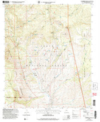
~ Sombrero Peak AZ topo map, 1:24000 scale, 7.5 X 7.5 Minute, Historical, 2004, updated 2007
Sombrero Peak, Arizona, USGS topographic map dated 2004.
Includes geographic coordinates (latitude and longitude). This topographic map is suitable for hiking, camping, and exploring, or framing it as a wall map.
Printed on-demand using high resolution imagery, on heavy weight and acid free paper, or alternatively on a variety of synthetic materials.
Topos available on paper, Waterproof, Poly, or Tyvek. Usually shipping rolled, unless combined with other folded maps in one order.
- Product Number: USGS-5555970
- Free digital map download (high-resolution, GeoPDF): Sombrero Peak, Arizona (file size: 14 MB)
- Map Size: please refer to the dimensions of the GeoPDF map above
- Weight (paper map): ca. 55 grams
- Map Type: POD USGS Topographic Map
- Map Series: HTMC
- Map Verison: Historical
- Cell ID: 42050
- Scan ID: 313425
- Imprint Year: 2007
- Woodland Tint: Yes
- Aerial Photo Year: 2003
- Datum: NAD83
- Map Projection: Universal Transverse Mercator
- Map published by United States Geological Survey
- Map published by United States Forest Service
- Map Language: English
- Scanner Resolution: 600 dpi
- Map Cell Name: Sombrero Peak
- Grid size: 7.5 X 7.5 Minute
- Date on map: 2004
- Map Scale: 1:24000
- Geographical region: Arizona, United States
Neighboring Maps:
All neighboring USGS topo maps are available for sale online at a variety of scales.
Spatial coverage:
Topo map Sombrero Peak, Arizona, covers the geographical area associated the following places:
- Bull Canyon - Javelina Spring - J Z Rogers Spring - Hog Mountain Spring - Kendrick Spring - Quail Spring Canyon - Cherry Number Three Tank - Leisure Spring - Cherry Number Two Tank - Bronco Tank - West Fork Oak Creek - Gila County - East Fork Spring - North Fork Cooper Forks - South Copper Fork Tank - Quail Spring - Ellison Ranch - Cottonwood Spring - Granite Basin Spring - Brower Tank - Sheep Wash - Flying H Ranch - Oak Spring - Sombrero Butte Tank - Hog Mountain - Little East Fork Spring - Bladder Spring - Bronco Canyon - Half Barrel Spring - Hinton Creek - Pueblo Canyon - Middle Trap Spring - South Fork Cooper Forks - Boulder Spring - Willow Spring - Pottery Point - Quell Spring Canyon - Deep Creek - Cane Spring - Moody Point - Dripping Spring - Devils Chasm - Lone Pine Divide - Peach Flat Tank - Rim-Moody Point Trail - Bladder Canyon - Hackberry Spring - Sombrero Peak - North Cooper Fork Tank - Cooper Forks - Leisure Canyon - Cherry Number One Tank - Bermuda Falls Spring - Little Sombrero Peak - Leisure Canyon Trailhead - Badlands - Shack Tank - Deep Creek Tank - Banning Wash - Sycamore Spring - Soldier Camp Wash - Cement Dam Tank - Cook Ranch - Wild Cow Tank - Short Chops Canyon - Moonshine Gulch - Moonshine Tank - Primrose Spring - Yellow Jacket Spring - Cold Spring Canyon - Peach Flat
- Map Area ID: AREA33.87533.75-110.875-110.75
- Northwest corner Lat/Long code: USGSNW33.875-110.875
- Northeast corner Lat/Long code: USGSNE33.875-110.75
- Southwest corner Lat/Long code: USGSSW33.75-110.875
- Southeast corner Lat/Long code: USGSSE33.75-110.75
- Northern map edge Latitude: 33.875
- Southern map edge Latitude: 33.75
- Western map edge Longitude: -110.875
- Eastern map edge Longitude: -110.75


