
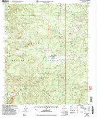
~ Rock House AZ topo map, 1:24000 scale, 7.5 X 7.5 Minute, Historical, 2004, updated 2006
Rock House, Arizona, USGS topographic map dated 2004.
Includes geographic coordinates (latitude and longitude). This topographic map is suitable for hiking, camping, and exploring, or framing it as a wall map.
Printed on-demand using high resolution imagery, on heavy weight and acid free paper, or alternatively on a variety of synthetic materials.
Topos available on paper, Waterproof, Poly, or Tyvek. Usually shipping rolled, unless combined with other folded maps in one order.
- Product Number: USGS-5555396
- Free digital map download (high-resolution, GeoPDF): Rock House, Arizona (file size: 13 MB)
- Map Size: please refer to the dimensions of the GeoPDF map above
- Weight (paper map): ca. 55 grams
- Map Type: POD USGS Topographic Map
- Map Series: HTMC
- Map Verison: Historical
- Cell ID: 38242
- Scan ID: 313115
- Imprint Year: 2006
- Woodland Tint: Yes
- Aerial Photo Year: 2003
- Datum: NAD83
- Map Projection: Universal Transverse Mercator
- Map published by United States Geological Survey
- Map published by United States Forest Service
- Map Language: English
- Scanner Resolution: 600 dpi
- Map Cell Name: Rock House
- Grid size: 7.5 X 7.5 Minute
- Date on map: 2004
- Map Scale: 1:24000
- Geographical region: Arizona, United States
Neighboring Maps:
All neighboring USGS topo maps are available for sale online at a variety of scales.
Spatial coverage:
Topo map Rock House, Arizona, covers the geographical area associated the following places:
- Middle Tank - Hobble Mesa - Horse Camp Mesa Tank - Horse Camp Windmill - Castle Butte Tank - Rock House - Middleton Mesa Spring - Horse Canyon Tank - Brush Top Tank - Castle Peak - Devils Playground Tank - Lone Pine Tank - Asbestos Spring - Well Camp Canyon - Cross Tank - Gunsight Butte - Brushy Top Mountain - Dead Cow Spring - Horse Camp - Middle Trap Spring - Duett Branch Tank - Well Camp Tank - Rodgers Tank - Sidehill Tank - Asbestos Tank - Horse Camp Mesa - Dry Bone Tank - Skid Tank - Campbell Creek - Lacey Forks Canyon - Juniper Tank - Double Buttes - Mineral Tank - House Spring - Middle Pasture Tank - Ironside Hill Tank - Middle Spring - Duett Tank - Copper Fork Tank
- Map Area ID: AREA3433.875-110.875-110.75
- Northwest corner Lat/Long code: USGSNW34-110.875
- Northeast corner Lat/Long code: USGSNE34-110.75
- Southwest corner Lat/Long code: USGSSW33.875-110.875
- Southeast corner Lat/Long code: USGSSE33.875-110.75
- Northern map edge Latitude: 34
- Southern map edge Latitude: 33.875
- Western map edge Longitude: -110.875
- Eastern map edge Longitude: -110.75


