
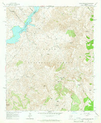
~ Pinyon Mountain AZ topo map, 1:24000 scale, 7.5 X 7.5 Minute, Historical, 1964, updated 1965
Pinyon Mountain, Arizona, USGS topographic map dated 1964.
Includes geographic coordinates (latitude and longitude). This topographic map is suitable for hiking, camping, and exploring, or framing it as a wall map.
Printed on-demand using high resolution imagery, on heavy weight and acid free paper, or alternatively on a variety of synthetic materials.
Topos available on paper, Waterproof, Poly, or Tyvek. Usually shipping rolled, unless combined with other folded maps in one order.
- Product Number: USGS-5555010
- Free digital map download (high-resolution, GeoPDF): Pinyon Mountain, Arizona (file size: 14 MB)
- Map Size: please refer to the dimensions of the GeoPDF map above
- Weight (paper map): ca. 55 grams
- Map Type: POD USGS Topographic Map
- Map Series: HTMC
- Map Verison: Historical
- Cell ID: 35405
- Scan ID: 312918
- Imprint Year: 1965
- Woodland Tint: Yes
- Aerial Photo Year: 1962
- Field Check Year: 1964
- Datum: NAD27
- Map Projection: Polyconic
- Map published by United States Geological Survey
- Map Language: English
- Scanner Resolution: 600 dpi
- Map Cell Name: Pinyon Mountain
- Grid size: 7.5 X 7.5 Minute
- Date on map: 1964
- Map Scale: 1:24000
- Geographical region: Arizona, United States
Neighboring Maps:
All neighboring USGS topo maps are available for sale online at a variety of scales.
Spatial coverage:
Topo map Pinyon Mountain, Arizona, covers the geographical area associated the following places:
- Bronco Spring - Plow Saddle - Plow Saddle Springs - Muskhog Tank - Pinyon Mountain - Windy Pass - Winger Spring - Cedar Basin Spring - Davis Wash - Two Bar Ridge - White Rock Spring - Lime Mountain Spring - Rainy Spring - Reavis Creek - Paradise Spring - Burnt Corral Creek - Bronco Creek - Lion Spring - Reavis Trailhead - Cedar Basin - Castle Dome - Mud Spring - Pine Creek - Yellowjacket Spring - Mazatzal Bay - Walnut Spring - Apache Trail - Water Dog Recreational Site - Hidden Spring - Ike Spring - Davis Spring - Klondike Spring - Maple Spring - Lime Mountain - Chukar Wash
- Map Area ID: AREA33.62533.5-111.25-111.125
- Northwest corner Lat/Long code: USGSNW33.625-111.25
- Northeast corner Lat/Long code: USGSNE33.625-111.125
- Southwest corner Lat/Long code: USGSSW33.5-111.25
- Southeast corner Lat/Long code: USGSSE33.5-111.125
- Northern map edge Latitude: 33.625
- Southern map edge Latitude: 33.5
- Western map edge Longitude: -111.25
- Eastern map edge Longitude: -111.125


