
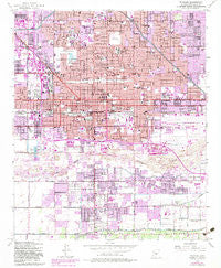
~ Phoenix AZ topo map, 1:24000 scale, 7.5 X 7.5 Minute, Historical, 1952, updated 1983
Phoenix, Arizona, USGS topographic map dated 1952.
Includes geographic coordinates (latitude and longitude). This topographic map is suitable for hiking, camping, and exploring, or framing it as a wall map.
Printed on-demand using high resolution imagery, on heavy weight and acid free paper, or alternatively on a variety of synthetic materials.
Topos available on paper, Waterproof, Poly, or Tyvek. Usually shipping rolled, unless combined with other folded maps in one order.
- Product Number: USGS-5554878
- Free digital map download (high-resolution, GeoPDF): Phoenix, Arizona (file size: 18 MB)
- Map Size: please refer to the dimensions of the GeoPDF map above
- Weight (paper map): ca. 55 grams
- Map Type: POD USGS Topographic Map
- Map Series: HTMC
- Map Verison: Historical
- Cell ID: 34989
- Scan ID: 312850
- Imprint Year: 1983
- Woodland Tint: Yes
- Visual Version Number: 1
- Photo Revision Year: 1982
- Aerial Photo Year: 1978
- Edit Year: 1982
- Field Check Year: 1952
- Datum: NAD27
- Map Projection: Polyconic
- Map published by United States Geological Survey
- Map published by United States Army
- Map Language: English
- Scanner Resolution: 600 dpi
- Map Cell Name: Phoenix
- Grid size: 7.5 X 7.5 Minute
- Date on map: 1952
- Map Scale: 1:24000
- Geographical region: Arizona, United States
Neighboring Maps:
All neighboring USGS topo maps are available for sale online at a variety of scales.
Spatial coverage:
Topo map Phoenix, Arizona, covers the geographical area associated the following places:
- Trail Inn Lodge - Sleepy Hollow Trailer Village - Washington Trailer Park - Cactus Cove Trailer Park - Valley Gardens Trailer Park - Green Acres Mobile and Recreational Vehicle Park - Sun Valley Trailer Park - Plaza Trailer Inn - Pecan Grove Trailer Park - Countryside Mobile Home Park - Chapparal Mobile Village - Lazy D Trailer Ranch - Palms Trailer Park - Thomas Trailer Court - Wigwam Villa Mobile Home Park - Green Valley Trailer Park - Southern Foothills Mobile Home Park - Squaw Peak Terrace - Country Club Trailer Grove - A-1 Trailer Park - McDowell Trailer Village - Rancho Hermoso - Westwood Mobile Home Park - A and F Trailer Park - Phoenix - Patrick Park - Roadrunner Mobile Home Park - Rancho Mobile Estates - South Phoenix - Blue Palm Mobile Home Park - Citrus Hills - Villa Monte Vista - Estrella Estates Family Park - Southern Acres Mobile Home Park - Broadway Trailer Court - Bel-Aire Trailer Park - Aristocrat Trailer Park (historical) - Grandview Mobile Home Park - Bronze Boot - Sun Trailer Park - El Sereno-La Rosa Trailer Inn - Camelback Trailer Ranch - DeLuxe Trailer Court
- Map Area ID: AREA33.533.375-112.125-112
- Northwest corner Lat/Long code: USGSNW33.5-112.125
- Northeast corner Lat/Long code: USGSNE33.5-112
- Southwest corner Lat/Long code: USGSSW33.375-112.125
- Southeast corner Lat/Long code: USGSSE33.375-112
- Northern map edge Latitude: 33.5
- Southern map edge Latitude: 33.375
- Western map edge Longitude: -112.125
- Eastern map edge Longitude: -112


