
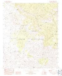
~ Park Creek Cabins AZ topo map, 1:24000 scale, 7.5 X 7.5 Minute, Historical, 1989, updated 1990
Park Creek Cabins, Arizona, USGS topographic map dated 1989.
Includes geographic coordinates (latitude and longitude). This topographic map is suitable for hiking, camping, and exploring, or framing it as a wall map.
Printed on-demand using high resolution imagery, on heavy weight and acid free paper, or alternatively on a variety of synthetic materials.
Topos available on paper, Waterproof, Poly, or Tyvek. Usually shipping rolled, unless combined with other folded maps in one order.
- Product Number: USGS-5554734
- Free digital map download (high-resolution, GeoPDF): Park Creek Cabins, Arizona (file size: 12 MB)
- Map Size: please refer to the dimensions of the GeoPDF map above
- Weight (paper map): ca. 55 grams
- Map Type: POD USGS Topographic Map
- Map Series: HTMC
- Map Verison: Historical
- Cell ID: 34218
- Scan ID: 312779
- Imprint Year: 1990
- Woodland Tint: Yes
- Aerial Photo Year: 1984
- Edit Year: 1989
- Field Check Year: 1987
- Datum: NAD27
- Map Projection: Transverse Mercator
- Provisional map: Yes
- Map published by United States Geological Survey
- Map Language: English
- Scanner Resolution: 600 dpi
- Map Cell Name: Park Creek Cabins
- Grid size: 7.5 X 7.5 Minute
- Date on map: 1989
- Map Scale: 1:24000
- Geographical region: Arizona, United States
Neighboring Maps:
All neighboring USGS topo maps are available for sale online at a variety of scales.
Spatial coverage:
Topo map Park Creek Cabins, Arizona, covers the geographical area associated the following places:
- Turkey Spring Corral - One V Well - Cold Spring - Bryce Horse Camp Tank - Jesse Tank - Red Seep Spring - Webster Spring - Bonita Well - Deadman Canyon - Park Creek Cabins - Mescal Spring - Black Mesa - Rose Garden Spring - Maverick Canyon Corral - Rabbit Trap Corral - Whiskey Ridge Tank - Oak Grove Tank - Mockingbird Spring - George Well - Red Box Corral - Maverick Canyon - Whiskey Well - Skeleton Tank - Whiskey Ridge - Cowboy Tank - Rainbow Well - Keays Tank
- Map Area ID: AREA33.2533.125-109.75-109.625
- Northwest corner Lat/Long code: USGSNW33.25-109.75
- Northeast corner Lat/Long code: USGSNE33.25-109.625
- Southwest corner Lat/Long code: USGSSW33.125-109.75
- Southeast corner Lat/Long code: USGSSE33.125-109.625
- Northern map edge Latitude: 33.25
- Southern map edge Latitude: 33.125
- Western map edge Longitude: -109.75
- Eastern map edge Longitude: -109.625


