
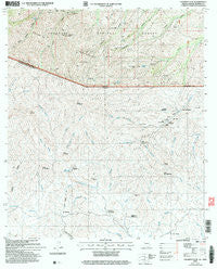
~ Pajarito Peak AZ topo map, 1:24000 scale, 7.5 X 7.5 Minute, Historical, 2004, updated 2007
Pajarito Peak, Arizona, USGS topographic map dated 2004.
Includes geographic coordinates (latitude and longitude). This topographic map is suitable for hiking, camping, and exploring, or framing it as a wall map.
Printed on-demand using high resolution imagery, on heavy weight and acid free paper, or alternatively on a variety of synthetic materials.
Topos available on paper, Waterproof, Poly, or Tyvek. Usually shipping rolled, unless combined with other folded maps in one order.
- Product Number: USGS-5554674
- Free digital map download (high-resolution, GeoPDF): Pajarito Peak, Arizona (file size: 13 MB)
- Map Size: please refer to the dimensions of the GeoPDF map above
- Weight (paper map): ca. 55 grams
- Map Type: POD USGS Topographic Map
- Map Series: HTMC
- Map Verison: Historical
- Cell ID: 33950
- Scan ID: 312749
- Imprint Year: 2007
- Woodland Tint: Yes
- Aerial Photo Year: 1996
- Edit Year: 2004
- Survey Year: 1975
- Datum: NAD83
- Map Projection: Universal Transverse Mercator
- Map published by United States Geological Survey
- Map published by United States Forest Service
- Map Language: English
- Scanner Resolution: 600 dpi
- Map Cell Name: Pajarito Peak
- Grid size: 7.5 X 7.5 Minute
- Date on map: 2004
- Map Scale: 1:24000
- Geographical region: Arizona, United States
Neighboring Maps:
All neighboring USGS topo maps are available for sale online at a variety of scales.
Spatial coverage:
Topo map Pajarito Peak, Arizona, covers the geographical area associated the following places:
- Adobe Spring - Bull Spring - Old Bextrum Mine - Davis Tank - Mud Tank - Split Tank - Pajarito Peak - Mojohave Ridge - Upper Alamo Tank - Sonny Tank - White Oak Mine - Pajarito Mountains - Pesquiera Tank - Tinker Dam - Sunset Mine - Lower Triangle Tank - Green Can Tank - Punk Tank - Walker Dam - Monument Tank - Mine Shaft Spring - Little Alamo Tank - Upper Calabasas Dam - Bull Spring Tank - Juniper Tank Dam - Lobo Tank - Three C Tank - Russell Spring - Calabasas Tank
- Map Area ID: AREA31.37531.25-111.125-111
- Northwest corner Lat/Long code: USGSNW31.375-111.125
- Northeast corner Lat/Long code: USGSNE31.375-111
- Southwest corner Lat/Long code: USGSSW31.25-111.125
- Southeast corner Lat/Long code: USGSSE31.25-111
- Northern map edge Latitude: 31.375
- Southern map edge Latitude: 31.25
- Western map edge Longitude: -111.125
- Eastern map edge Longitude: -111


