
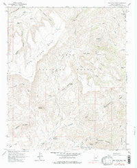
~ New River Mesa AZ topo map, 1:24000 scale, 7.5 X 7.5 Minute, Historical, 1964, updated 1987
New River Mesa, Arizona, USGS topographic map dated 1964.
Includes geographic coordinates (latitude and longitude). This topographic map is suitable for hiking, camping, and exploring, or framing it as a wall map.
Printed on-demand using high resolution imagery, on heavy weight and acid free paper, or alternatively on a variety of synthetic materials.
Topos available on paper, Waterproof, Poly, or Tyvek. Usually shipping rolled, unless combined with other folded maps in one order.
- Product Number: USGS-5554402
- Free digital map download (high-resolution, GeoPDF): New River Mesa, Arizona (file size: 13 MB)
- Map Size: please refer to the dimensions of the GeoPDF map above
- Weight (paper map): ca. 55 grams
- Map Type: POD USGS Topographic Map
- Map Series: HTMC
- Map Verison: Historical
- Cell ID: 31839
- Scan ID: 312616
- Imprint Year: 1987
- Woodland Tint: Yes
- Photo Inspection Year: 1978
- Aerial Photo Year: 1962
- Field Check Year: 1964
- Datum: NAD27
- Map Projection: Polyconic
- Map published by United States Geological Survey
- Map Language: English
- Scanner Resolution: 600 dpi
- Map Cell Name: New River Mesa
- Grid size: 7.5 X 7.5 Minute
- Date on map: 1964
- Map Scale: 1:24000
- Geographical region: Arizona, United States
Neighboring Maps:
All neighboring USGS topo maps are available for sale online at a variety of scales.
Spatial coverage:
Topo map New River Mesa, Arizona, covers the geographical area associated the following places:
- Chalk Spring - Mesa Tank - Rock Tank Spring - Lewis Spring - Big Maggie May - Elephant Mountain - Robbers Roost Canyon - Quien Sabe Mine - Ruin Tank - Spur Cross Ranch Conservation Area - Mattys Fork - Black Mesa - Reed Tank - Flemming Spring - Skunk Tank Canyon - Big Tank - Liscum - Cottonwood Spring - Sugarloaf Mountain - Skunk Tank - Little Wonder Spring - New River Mesa - Quien Sabe Peak - Little Grapevine Canyon - Maggie May Spring - Shulte Spring - Phoenix Mine - Cottonwood Creek - Robbers Roost Spring - Division Tank - Cement Spring - New River Mesa Tank - Maricopa Mine - Road Tank - Burro Spring - Quien Sabe Spring - Grays Gulch - Ashdale Administrative Site - Cottonwood Spring - Lopez Tank - Board Spring - Skunk Ridge - Cramm Mountain - Little Grapevine Tank - Continental Mountain - Middle Tank - Skull Mesa - Skunk Basin - Flemming Wash - Chalk Canyon - Grays Gulch Mine - Quien Sabe Creek
- Map Area ID: AREA3433.875-112-111.875
- Northwest corner Lat/Long code: USGSNW34-112
- Northeast corner Lat/Long code: USGSNE34-111.875
- Southwest corner Lat/Long code: USGSSW33.875-112
- Southeast corner Lat/Long code: USGSSE33.875-111.875
- Northern map edge Latitude: 34
- Southern map edge Latitude: 33.875
- Western map edge Longitude: -112
- Eastern map edge Longitude: -111.875


