
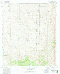
~ Murphy Peak AZ topo map, 1:24000 scale, 7.5 X 7.5 Minute, Historical, 1981, updated 1981
Murphy Peak, Arizona, USGS topographic map dated 1981.
Includes geographic coordinates (latitude and longitude). This topographic map is suitable for hiking, camping, and exploring, or framing it as a wall map.
Printed on-demand using high resolution imagery, on heavy weight and acid free paper, or alternatively on a variety of synthetic materials.
Topos available on paper, Waterproof, Poly, or Tyvek. Usually shipping rolled, unless combined with other folded maps in one order.
- Product Number: USGS-5554300
- Free digital map download (high-resolution, GeoPDF): Murphy Peak, Arizona (file size: 11 MB)
- Map Size: please refer to the dimensions of the GeoPDF map above
- Weight (paper map): ca. 55 grams
- Map Type: POD USGS Topographic Map
- Map Series: HTMC
- Map Verison: Historical
- Cell ID: 31159
- Scan ID: 312560
- Imprint Year: 1981
- Woodland Tint: Yes
- Aerial Photo Year: 1975
- Edit Year: 1981
- Field Check Year: 1978
- Datum: NAD27
- Map Projection: Transverse Mercator
- Map published by United States Geological Survey
- Map Language: English
- Scanner Resolution: 600 dpi
- Map Cell Name: Murphy Peak
- Grid size: 7.5 X 7.5 Minute
- Date on map: 1981
- Map Scale: 1:24000
- Geographical region: Arizona, United States
Neighboring Maps:
All neighboring USGS topo maps are available for sale online at a variety of scales.
Spatial coverage:
Topo map Murphy Peak, Arizona, covers the geographical area associated the following places:
- Beehive Dam - White Tank - Apache Canyon - Sardina Dam - Dry Dam - Lobo Canyon - Middle Sardina Dam - Red Spring - Amole Tank - Red Spring Pass - Diversion Tank - Cedar Windmill - Jalisco Well - Upper Puerto Tank - Apache Pass Dam - Apache Pass - East Fork Apache Canyon - Indian Hills Tank - Moyza Tank - Bartolo Mountain - Lower Sardina Well - Apache Well - Sardina Well - Turtle Spring - Twin Peaks - Clifford Well - Murphy Peak - Cajon Tank - Murphy Canyon - Midway Well - Murphy Well - Red Spring Tank - Jalisco Ridge - Chapman Tank - Bear Grass Tank - Jalisco Canyon - Bartolo Canyon - Moyza Well - Noon Tank - Cedar Well - Papalote Well - Cedar Dam - Dicks Peak Tank - Papalote Tank - Jalisco Dam - Midway Tank - Lobo Tank - Dicks Peak - Red Hill Tank
- Map Area ID: AREA31.62531.5-111.25-111.125
- Northwest corner Lat/Long code: USGSNW31.625-111.25
- Northeast corner Lat/Long code: USGSNE31.625-111.125
- Southwest corner Lat/Long code: USGSSW31.5-111.25
- Southeast corner Lat/Long code: USGSSE31.5-111.125
- Northern map edge Latitude: 31.625
- Southern map edge Latitude: 31.5
- Western map edge Longitude: -111.25
- Eastern map edge Longitude: -111.125


