
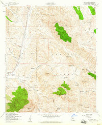
~ Mt Hughes AZ topo map, 1:24000 scale, 7.5 X 7.5 Minute, Historical, 1958, updated 1960
Mt Hughes, Arizona, USGS topographic map dated 1958.
Includes geographic coordinates (latitude and longitude). This topographic map is suitable for hiking, camping, and exploring, or framing it as a wall map.
Printed on-demand using high resolution imagery, on heavy weight and acid free paper, or alternatively on a variety of synthetic materials.
Topos available on paper, Waterproof, Poly, or Tyvek. Usually shipping rolled, unless combined with other folded maps in one order.
- Product Number: USGS-5554232
- Free digital map download (high-resolution, GeoPDF): Mt Hughes, Arizona (file size: 15 MB)
- Map Size: please refer to the dimensions of the GeoPDF map above
- Weight (paper map): ca. 55 grams
- Map Type: POD USGS Topographic Map
- Map Series: HTMC
- Map Verison: Historical
- Cell ID: 30648
- Scan ID: 312525
- Imprint Year: 1960
- Woodland Tint: Yes
- Aerial Photo Year: 1946
- Edit Year: 1958
- Field Check Year: 1948
- Datum: NAD27
- Map Projection: Polyconic
- Map published by United States Geological Survey
- Map published by United States Army Corps of Engineers
- Map Language: English
- Scanner Resolution: 600 dpi
- Map Cell Name: Mount Hughes
- Grid size: 7.5 X 7.5 Minute
- Date on map: 1958
- Map Scale: 1:24000
- Geographical region: Arizona, United States
Neighboring Maps:
All neighboring USGS topo maps are available for sale online at a variety of scales.
Spatial coverage:
Topo map Mt Hughes, Arizona, covers the geographical area associated the following places:
- Aztec Group Mines - Red Bank Well - Lampshire Canyon - Copper Mountain - Redrock Well - Gunther Tank - Seibold Ranch - Smith Canyon - Big Casa Blanca Canyon - Hells Canyon Dam - Holding Pasture Trick Tank - Redrock Canyon - Santa Cruz Mine - Ashburn Mountain - North Saddle Mountain - Oak Grove Spring - Stevens Canyon - Ashburn (historical) - South Well - East Tank - Bible Spring - Cottonwood Spring Number Two - Redrock Ranch - Turtle Spring - Lazy RR Ranch - Saddle Mountain Tank - Harshaw Creek - Weiland Harshaw Storage - Red Mountain - Turner Ranch - Gate Spring - Kennedy Spring - Saddle Spring - Bat Cave Tank - East Well - Bergier Ranch - Candelerio Peak - Papago Spring - Patagonia Ranger Station - Casa Blanca (historical) - Crittenden - Mount Hughes - Fortune Ranch - Patagonia Elementary School - Meadow Spring - Patagonia Union High School - Weiland Harshaw Well - Cottonwood Spring - Wood Canyon - Christmas Gift Mine - Gate Horizontal Well - Lion Dam - Dry Canyon - Lewis Ranch - Stevens Ranch - Sansimon Mine - Indian Head Mountain - Bergier Trick Tank - Elevation Group Mines - Town of Patagonia - Kunde Mountain - Dark Canyon - Patagonia Division - Little Casa Blanca Canyon - Corral Canyon - Box Canyon - Cottonwood Spring
- Map Area ID: AREA31.62531.5-110.75-110.625
- Northwest corner Lat/Long code: USGSNW31.625-110.75
- Northeast corner Lat/Long code: USGSNE31.625-110.625
- Southwest corner Lat/Long code: USGSSW31.5-110.75
- Southeast corner Lat/Long code: USGSSE31.5-110.625
- Northern map edge Latitude: 31.625
- Southern map edge Latitude: 31.5
- Western map edge Longitude: -110.75
- Eastern map edge Longitude: -110.625


