
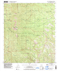
~ Mount Wrightson AZ topo map, 1:24000 scale, 7.5 X 7.5 Minute, Historical, 1996, updated 2002
Mount Wrightson, Arizona, USGS topographic map dated 1996.
Includes geographic coordinates (latitude and longitude). This topographic map is suitable for hiking, camping, and exploring, or framing it as a wall map.
Printed on-demand using high resolution imagery, on heavy weight and acid free paper, or alternatively on a variety of synthetic materials.
Topos available on paper, Waterproof, Poly, or Tyvek. Usually shipping rolled, unless combined with other folded maps in one order.
- Product Number: USGS-5554196
- Free digital map download (high-resolution, GeoPDF): Mount Wrightson, Arizona (file size: 12 MB)
- Map Size: please refer to the dimensions of the GeoPDF map above
- Weight (paper map): ca. 55 grams
- Map Type: POD USGS Topographic Map
- Map Series: HTMC
- Map Verison: Historical
- Cell ID: 30911
- Scan ID: 703727
- Imprint Year: 2002
- Woodland Tint: Yes
- Aerial Photo Year: 1996
- Datum: NAD83
- Map Projection: Universal Transverse Mercator
- Map published by United States Geological Survey
- Map Language: English
- Scanner Resolution: 508 dpi
- Map Cell Name: Mount Wrightson
- Grid size: 7.5 X 7.5 Minute
- Date on map: 1996
- Map Scale: 1:24000
- Geographical region: Arizona, United States
Neighboring Maps:
All neighboring USGS topo maps are available for sale online at a variety of scales.
Spatial coverage:
Topo map Mount Wrightson, Arizona, covers the geographical area associated the following places:
- Hosey Mine - Rock Candy Mountain Mine - Walker Basin - Little Joker Mine - Cave Creek - Wildcat Mine - Florida Mine - Fish Canyon Tank - Juniper Well - Tiajuana Mine - Fish Well Corral - Baldy Saddle - Jack Mountain - Josephine Peak - Florida Spring - Aliso Spring - Sylvester Spring - Tunnel Spring - Onal Recreation Trail - Dutch John Spring - East Sawmill Canyon - Little Casa Tank - Roundup Picnic Ground - Ditch Mountain - Santa Rita (historical) - Old Baldy - Daniels Mine - Arizona Pittsburg Mine - Baldy Spring - Juniper Flat - Copper Canyon - Anaconda Spring - Sawmill Canyon Trail 146 - McBeth Spring - Kent Spring Trail 156 - Bear Spring - Double Header Mine - Bathtub Water - Bog Springs - Armour Spring - Walker Basin Trail Number One Hundred Thirty Six - Walker Mine - Sweetwater Spring - Florida Saddle - Bathtub Tank - Walker Canyon - Ojero Mine (historical) - Kent Spring - Upper Walker Tank - Sawmill Spring - Florida Peak - Sprung Spring - Little Shot Mine - Old Baldy National Recreation Trail Loop - Sweetwater Baldy Saddle Trail 143 - Canyon Tank - Old Madera Mine - Jones Canyon - Josephine Saddle - Saint Louis Mine - Crystal Mine (historical) - Dixie Mine - Philadelphia Mine - Armada Mine - Cave Canyon Trail One Hundred Forty-Seven - El Pilar Tank - McCleary Peak - Black Eagle Mine - Lucky Ledge Mine - Robinson Spring - Snyder Mine - Bellows Spring - Mount Wrightson Wilderness - Ultimo Mine - Sawmill Canyon Tank - Mount Wrightson - Silver King Mine - East Compadre Shaft - Green Dam - Connecticut Mine - Riley Saddle
- Map Area ID: AREA31.7531.625-110.875-110.75
- Northwest corner Lat/Long code: USGSNW31.75-110.875
- Northeast corner Lat/Long code: USGSNE31.75-110.75
- Southwest corner Lat/Long code: USGSSW31.625-110.875
- Southeast corner Lat/Long code: USGSSE31.625-110.75
- Northern map edge Latitude: 31.75
- Southern map edge Latitude: 31.625
- Western map edge Longitude: -110.875
- Eastern map edge Longitude: -110.75


