
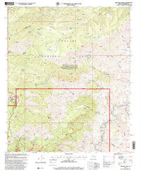
~ Mitchell Peak AZ topo map, 1:24000 scale, 7.5 X 7.5 Minute, Historical, 1997, updated 2000
Mitchell Peak, Arizona, USGS topographic map dated 1997.
Includes geographic coordinates (latitude and longitude). This topographic map is suitable for hiking, camping, and exploring, or framing it as a wall map.
Printed on-demand using high resolution imagery, on heavy weight and acid free paper, or alternatively on a variety of synthetic materials.
Topos available on paper, Waterproof, Poly, or Tyvek. Usually shipping rolled, unless combined with other folded maps in one order.
- Product Number: USGS-5553966
- Free digital map download (high-resolution, GeoPDF): Mitchell Peak, Arizona (file size: 16 MB)
- Map Size: please refer to the dimensions of the GeoPDF map above
- Weight (paper map): ca. 55 grams
- Map Type: POD USGS Topographic Map
- Map Series: HTMC
- Map Verison: Historical
- Cell ID: 29669
- Scan ID: 312390
- Imprint Year: 2000
- Woodland Tint: Yes
- Aerial Photo Year: 1992
- Edit Year: 1997
- Datum: NAD27
- Map Projection: Transverse Mercator
- Map published by United States Geological Survey
- Map published by United States Forest Service
- Map Language: English
- Scanner Resolution: 600 dpi
- Map Cell Name: Mitchell Peak
- Grid size: 7.5 X 7.5 Minute
- Date on map: 1997
- Map Scale: 1:24000
- Geographical region: Arizona, United States
Neighboring Maps:
All neighboring USGS topo maps are available for sale online at a variety of scales.
Spatial coverage:
Topo map Mitchell Peak, Arizona, covers the geographical area associated the following places:
- Silver Creek - Moonshine Canyon - Don Smith Spring - Stevens Tank - Sardine Saddle Spring - Woodsy Spring - Malpais Mountain - Lopez Spring - Butte Spring - Woods Canyon - Santa Cruz Canyon - Lower Cave Creek Spring - Cruz Spring - Sunset Canyon - Bee Spring - McBride Spring - H L Canyon Eleven Trail - West Yellowjacket Spring - Santa Cruz Corral - Dog Flat Corral - Roughout Spring - Woods Spring - Walker Butte Spring - Hill Spring - Shorty Spring - Wood Spring Corral - Sardine Saddle Picnic Area - Walnut Spring - Sycamore Gulch - Cement Tank Corral - Coronado Spring - Mitchell Spring - Chesser Canyon - Well Spring - Elbow Spring - Garfield Gulch - Prieto Plateau - Walnut Spring - Palace Canyon - Pinal Point - Fry Spring - Fry Canyon - Cave Creek Corral - Ouail Spring - Cave Creek - Saddle Corral - Rim Tank - Sardine Spring - Mud Spring - Pine Tank - Frye Trail Twelve - Prieto Plateau Tank - Dam Tank - Layout Mesa - Walker Butte - Divide Spring - Stevens Mine - Hackberry Canyon - Prieto Tank - Upper Sardine Spring - Lower Sardine Spring - H L Spring - Final Point - Orejana Spring - Pine Spring - Dog Flat Tank - Buck Park - Pigeon Canyon Spring - XA Spring - Assessment Tank - Rincon Canyon - Mitchell Peak - Buck Park Tank - Sardine Falls - Cement Tank - Wing Tank - Red Rock Spring - Upper Cove Creek Spring - Quail Spring - Bend Spring - Malpais Corral - Lopez Corral - The Door Spring
- Map Area ID: AREA33.2533.125-109.375-109.25
- Northwest corner Lat/Long code: USGSNW33.25-109.375
- Northeast corner Lat/Long code: USGSNE33.25-109.25
- Southwest corner Lat/Long code: USGSSW33.125-109.375
- Southeast corner Lat/Long code: USGSSE33.125-109.25
- Northern map edge Latitude: 33.25
- Southern map edge Latitude: 33.125
- Western map edge Longitude: -109.375
- Eastern map edge Longitude: -109.25


