
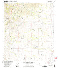
~ Mildred Peak AZ topo map, 1:24000 scale, 7.5 X 7.5 Minute, Historical, 1979, updated 1979
Mildred Peak, Arizona, USGS topographic map dated 1979.
Includes geographic coordinates (latitude and longitude). This topographic map is suitable for hiking, camping, and exploring, or framing it as a wall map.
Printed on-demand using high resolution imagery, on heavy weight and acid free paper, or alternatively on a variety of synthetic materials.
Topos available on paper, Waterproof, Poly, or Tyvek. Usually shipping rolled, unless combined with other folded maps in one order.
- Product Number: USGS-5553912
- Free digital map download (high-resolution, GeoPDF): Mildred Peak, Arizona (file size: 10 MB)
- Map Size: please refer to the dimensions of the GeoPDF map above
- Weight (paper map): ca. 55 grams
- Map Type: POD USGS Topographic Map
- Map Series: HTMC
- Map Verison: Historical
- Cell ID: 29238
- Scan ID: 312363
- Imprint Year: 1979
- Woodland Tint: Yes
- Visual Version Number: 2
- Aerial Photo Year: 1974
- Edit Year: 1979
- Field Check Year: 1975
- Datum: NAD27
- Map Projection: Transverse Mercator
- Map published by United States Geological Survey
- Map Language: English
- Scanner Resolution: 600 dpi
- Map Cell Name: Mildred Peak
- Grid size: 7.5 X 7.5 Minute
- Date on map: 1979
- Map Scale: 1:24000
- Geographical region: Arizona, United States
Neighboring Maps:
All neighboring USGS topo maps are available for sale online at a variety of scales.
Spatial coverage:
Topo map Mildred Peak, Arizona, covers the geographical area associated the following places:
- Mitchell Tank - Indian Tank - Thomas Canyon - Fourteen Tank - Placeritos Wash - Charlie Bent Well - Weaver Canyon - Cemetery Tank - Thomas Well - Escondido Wash - Chutum Vaya Pass - Shaffer Camp - Las Moras Ranch - Corodope Spring - Cerro Prieto - Shute Tank - Osobavi Peak - Escondido Spring - Santa Margarita Ranch - Leyvas Canyon - Jackknife Tank - West Brown Tank - Jupiter Canyon - Milpa Tank - Twin Tanks - Elgin School - Black Tank - Gold Bullion Mine - Jupiter Mine - Mildred Peak - Mormon Tank - Middle Tank - Seven X Tank - Clemente Windmill - Arroyo del Puente
- Map Area ID: AREA31.7531.625-111.625-111.5
- Northwest corner Lat/Long code: USGSNW31.75-111.625
- Northeast corner Lat/Long code: USGSNE31.75-111.5
- Southwest corner Lat/Long code: USGSSW31.625-111.625
- Southeast corner Lat/Long code: USGSSE31.625-111.5
- Northern map edge Latitude: 31.75
- Southern map edge Latitude: 31.625
- Western map edge Longitude: -111.625
- Eastern map edge Longitude: -111.5


