
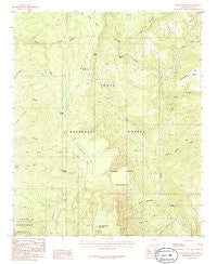
~ McFadden Peak AZ topo map, 1:24000 scale, 7.5 X 7.5 Minute, Historical, 1986, updated 1986
McFadden Peak, Arizona, USGS topographic map dated 1986.
Includes geographic coordinates (latitude and longitude). This topographic map is suitable for hiking, camping, and exploring, or framing it as a wall map.
Printed on-demand using high resolution imagery, on heavy weight and acid free paper, or alternatively on a variety of synthetic materials.
Topos available on paper, Waterproof, Poly, or Tyvek. Usually shipping rolled, unless combined with other folded maps in one order.
- Product Number: USGS-5553754
- Free digital map download (high-resolution, GeoPDF): McFadden Peak, Arizona (file size: 13 MB)
- Map Size: please refer to the dimensions of the GeoPDF map above
- Weight (paper map): ca. 55 grams
- Map Type: POD USGS Topographic Map
- Map Series: HTMC
- Map Verison: Historical
- Cell ID: 28363
- Scan ID: 312280
- Imprint Year: 1986
- Woodland Tint: Yes
- Aerial Photo Year: 1981
- Edit Year: 1986
- Field Check Year: 1988
- Datum: NAD27
- Map Projection: Transverse Mercator
- Provisional map: Yes
- Map published by United States Geological Survey
- Map Language: English
- Scanner Resolution: 600 dpi
- Map Cell Name: McFadden Peak
- Grid size: 7.5 X 7.5 Minute
- Date on map: 1986
- Map Scale: 1:24000
- Geographical region: Arizona, United States
Neighboring Maps:
All neighboring USGS topo maps are available for sale online at a variety of scales.
Spatial coverage:
Topo map McFadden Peak, Arizona, covers the geographical area associated the following places:
- Olliger Mesa Tank - Horse Mountain Tank - Pendleton Tank - Dads Tank - Turkey Spring - Ash Creek Spring - P B Spring - Pine Mountain - Billy Lawrence Canyon - Horse Tank Creek - China Spring Creek - Paul Tank - Elephant Rock - Rhinehart Tank - Chinaman Tank - McFadden Peak Lookout - China Spring Tank - Cold Water Canyon - Cow Flat Mountain - Ash Creek Corral Spring - Billy Lawrence Creek - East Spear Creek - Park Tank - Board Tree Spring - Pendleton Mesa - P B Creek - Circle Ranch - Cow Flat Tank - Gunsight Tank - Juniper Flat - Reg Tank - Gold Creek - Wilson Creek - McFadden Peak - Board Tree Saddle Tank - Board Tree Saddle - McFadden Horse Mountain - P B Ranch - Deep Creek - Ash Creek - Juniper Flat Tank
- Map Area ID: AREA3433.875-111-110.875
- Northwest corner Lat/Long code: USGSNW34-111
- Northeast corner Lat/Long code: USGSNE34-110.875
- Southwest corner Lat/Long code: USGSSW33.875-111
- Southeast corner Lat/Long code: USGSSE33.875-110.875
- Northern map edge Latitude: 34
- Southern map edge Latitude: 33.875
- Western map edge Longitude: -111
- Eastern map edge Longitude: -110.875


