
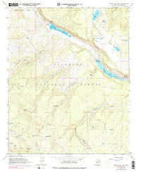
~ Lower Lake Mary AZ topo map, 1:24000 scale, 7.5 X 7.5 Minute, Historical, 1962, updated 1990
Lower Lake Mary, Arizona, USGS topographic map dated 1962.
Includes geographic coordinates (latitude and longitude). This topographic map is suitable for hiking, camping, and exploring, or framing it as a wall map.
Printed on-demand using high resolution imagery, on heavy weight and acid free paper, or alternatively on a variety of synthetic materials.
Topos available on paper, Waterproof, Poly, or Tyvek. Usually shipping rolled, unless combined with other folded maps in one order.
- Product Number: USGS-5553544
- Free digital map download (high-resolution, GeoPDF): Lower Lake Mary, Arizona (file size: 10 MB)
- Map Size: please refer to the dimensions of the GeoPDF map above
- Weight (paper map): ca. 55 grams
- Map Type: POD USGS Topographic Map
- Map Series: HTMC
- Map Verison: Historical
- Cell ID: 26799
- Scan ID: 312175
- Imprint Year: 1990
- Woodland Tint: Yes
- Photo Inspection Year: 1980
- Photo Revision Year: 1974
- Aerial Photo Year: 1974
- Field Check Year: 1962
- Datum: NAD27
- Map Projection: Polyconic
- Map published by United States Geological Survey
- Map published by United States Forest Service
- Map Language: English
- Scanner Resolution: 600 dpi
- Map Cell Name: Lower Lake Mary
- Grid size: 7.5 X 7.5 Minute
- Date on map: 1962
- Map Scale: 1:24000
- Geographical region: Arizona, United States
Neighboring Maps:
All neighboring USGS topo maps are available for sale online at a variety of scales.
Spatial coverage:
Topo map Lower Lake Mary, Arizona, covers the geographical area associated the following places:
- Natural Tank - Corner Tank - Upper Lake Mary Dam - Newman Tank - Marshall Mesa Tank - Elk Park Meadows - Mustang Park Tank - Lower Lake Mary Dam - Lagunita Tank - Hoxworth Springs - Nameless Tank - Lake Mary Meadows - Double Tank - Vail Lake - Peterson Seepage - Lower Lake Mary Picnic Area - Howard Draw - Priest Draw - United States Geological Survey Observatory - Mount Lion Tank - Westec Tank - Canyon Vista Campground - Narrows Boat Launch - JAO Well - Lost Tank - Wild Horse Tank - Marshall Lake - Upper Lake Mary Boat Launch Number 2 - Lower Tank - Hoxworth Tank - Highlands Fire District Station 24 Lake Mary - Lake View Forest Camp - Little Dry Lake Tank - KZJC-TV (Flagstaff) - Prime Lake - Lower Lake Mary - Sinkhole Tank - Cañada Granda Tank - Coulter Park - Stump Tank - Fisher and Fry Lake - Vail Lake Tank - Hold Up Tank - Pit One Tank - Hey Dog Tank - Coulter Hill - Clark Well - Rocky Tank - Little Dry Lake - Statler Tank - Johnneys Tank - Babbit Spring - Lake Number One - Charco Tank - Howard Tank - Roadbed Tank - Forest Service Tank - Pit Number Two Tank - Joeys Tank - Coulter Cabin - Perkins Telescope - Lake Mary Boating Site - Bonita Tank - Thomas Spring
- Map Area ID: AREA35.12535-111.625-111.5
- Northwest corner Lat/Long code: USGSNW35.125-111.625
- Northeast corner Lat/Long code: USGSNE35.125-111.5
- Southwest corner Lat/Long code: USGSSW35-111.625
- Southeast corner Lat/Long code: USGSSE35-111.5
- Northern map edge Latitude: 35.125
- Southern map edge Latitude: 35
- Western map edge Longitude: -111.625
- Eastern map edge Longitude: -111.5


