
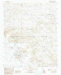
~ Kofa Butte AZ topo map, 1:24000 scale, 7.5 X 7.5 Minute, Historical, 1990, updated 1990
Kofa Butte, Arizona, USGS topographic map dated 1990.
Includes geographic coordinates (latitude and longitude). This topographic map is suitable for hiking, camping, and exploring, or framing it as a wall map.
Printed on-demand using high resolution imagery, on heavy weight and acid free paper, or alternatively on a variety of synthetic materials.
Topos available on paper, Waterproof, Poly, or Tyvek. Usually shipping rolled, unless combined with other folded maps in one order.
- Product Number: USGS-5553236
- Free digital map download (high-resolution, GeoPDF): Kofa Butte, Arizona (file size: 11 MB)
- Map Size: please refer to the dimensions of the GeoPDF map above
- Weight (paper map): ca. 55 grams
- Map Type: POD USGS Topographic Map
- Map Series: HTMC
- Map Verison: Historical
- Cell ID: 23928
- Scan ID: 312018
- Imprint Year: 1990
- Aerial Photo Year: 1985
- Edit Year: 1990
- Field Check Year: 1987
- Datum: NAD27
- Map Projection: Transverse Mercator
- Provisional map: Yes
- Map published by United States Geological Survey
- Map Language: English
- Scanner Resolution: 600 dpi
- Map Cell Name: Kofa Butte
- Grid size: 7.5 X 7.5 Minute
- Date on map: 1990
- Map Scale: 1:24000
- Geographical region: Arizona, United States
Neighboring Maps:
All neighboring USGS topo maps are available for sale online at a variety of scales.
Spatial coverage:
Topo map Kofa Butte, Arizona, covers the geographical area associated the following places:
- Polaris Mountain - King of Arizona Mine - Deep Well - Kofa National Wildlife Refuge - I X L Mine - North Star Well - North Star Wash - Wilbanks Cabin - Kofa Dam - Moonshine Tank - Kofa Dam Wash - Mid Well - Eagle Mine - Raven Tank - Big Horn Pass - Rob Roy Well - Wilbanks Well - Natural Arch - Black Dahlia Mine - North Star Mine - Dry Well - Kofa Mountains - Rob Roy Mine - Yaqui Wash - Kofa Butte - King Well - High Henry Mine - C O D Mine - Yaqui Tanks - Baker Mine - Evening Star Mine
- Map Area ID: AREA33.37533.25-114-113.875
- Northwest corner Lat/Long code: USGSNW33.375-114
- Northeast corner Lat/Long code: USGSNE33.375-113.875
- Southwest corner Lat/Long code: USGSSW33.25-114
- Southeast corner Lat/Long code: USGSSE33.25-113.875
- Northern map edge Latitude: 33.375
- Southern map edge Latitude: 33.25
- Western map edge Longitude: -114
- Eastern map edge Longitude: -113.875


