
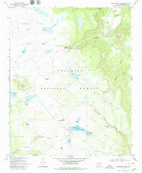
~ Kinnikinick Lake AZ topo map, 1:24000 scale, 7.5 X 7.5 Minute, Historical, 1970, updated 1979
Kinnikinick Lake, Arizona, USGS topographic map dated 1970.
Includes geographic coordinates (latitude and longitude). This topographic map is suitable for hiking, camping, and exploring, or framing it as a wall map.
Printed on-demand using high resolution imagery, on heavy weight and acid free paper, or alternatively on a variety of synthetic materials.
Topos available on paper, Waterproof, Poly, or Tyvek. Usually shipping rolled, unless combined with other folded maps in one order.
- Product Number: USGS-5553186
- Free digital map download (high-resolution, GeoPDF): Kinnikinick Lake, Arizona (file size: 9 MB)
- Map Size: please refer to the dimensions of the GeoPDF map above
- Weight (paper map): ca. 55 grams
- Map Type: POD USGS Topographic Map
- Map Series: HTMC
- Map Verison: Historical
- Cell ID: 72422
- Scan ID: 311989
- Imprint Year: 1979
- Woodland Tint: Yes
- Aerial Photo Year: 1962
- Field Check Year: 1970
- Datum: NAD27
- Map Projection: Polyconic
- Map published by United States Geological Survey
- Map Language: English
- Scanner Resolution: 600 dpi
- Map Cell Name: Kinnikinick Lake
- Grid size: 7.5 X 7.5 Minute
- Date on map: 1970
- Map Scale: 1:24000
- Geographical region: Arizona, United States
Neighboring Maps:
All neighboring USGS topo maps are available for sale online at a variety of scales.
Spatial coverage:
Topo map Kinnikinick Lake, Arizona, covers the geographical area associated the following places:
- D-Bart Tank - Dead Horse Tank - Yeager Number One Tank - Anderson Tank Number Two - Tule Tank - Cow Tank - Pine Lake - Boot Tank - Gonzalo Tank Number Two - Cow Lake - Corner Tank - Corral Tank - Unit East Tank - Dry Lake Tank - Antelope Tank - Morton Canyon Wash - Dove Tank - Pine Hill - Yaeger Lake - Anderson Tank Number One - Anderson Draw - Mud Lake Tank - Upper Long Tank - Long Lake - Morton Dam - Burro Spring - Yaeger Tank - McDermit Lake - Diversion Dam - Gonzalo Tank Number One - Replacement Tank - North Kinnikinick Tank - Pine Lake Tank - Boot Junior Tank - North Kinnikinick Tank - Antelope Lake - Kinnikinick Lake Boat Launch - Mud Lake - Kinnikinick Spring - Pollino Tank - Raymond Tank - Morton Lake - Kinnikinick Lake - Kinnikinick Dam - Boot Lake - Yeager Draw - Kinnikinick Campground - Ditch Tank - Bills Tank - Corner Lake - High N Dry Tank - Anderson Spring - Antelope Tank
- Map Area ID: AREA3534.875-111.375-111.25
- Northwest corner Lat/Long code: USGSNW35-111.375
- Northeast corner Lat/Long code: USGSNE35-111.25
- Southwest corner Lat/Long code: USGSSW34.875-111.375
- Southeast corner Lat/Long code: USGSSE34.875-111.25
- Northern map edge Latitude: 35
- Southern map edge Latitude: 34.875
- Western map edge Longitude: -111.375
- Eastern map edge Longitude: -111.25


