
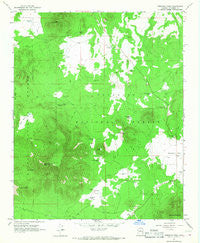
~ Kendrick Peak AZ topo map, 1:24000 scale, 7.5 X 7.5 Minute, Historical, 1966, updated 1968
Kendrick Peak, Arizona, USGS topographic map dated 1966.
Includes geographic coordinates (latitude and longitude). This topographic map is suitable for hiking, camping, and exploring, or framing it as a wall map.
Printed on-demand using high resolution imagery, on heavy weight and acid free paper, or alternatively on a variety of synthetic materials.
Topos available on paper, Waterproof, Poly, or Tyvek. Usually shipping rolled, unless combined with other folded maps in one order.
- Product Number: USGS-5553132
- Free digital map download (high-resolution, GeoPDF): Kendrick Peak, Arizona (file size: 11 MB)
- Map Size: please refer to the dimensions of the GeoPDF map above
- Weight (paper map): ca. 55 grams
- Map Type: POD USGS Topographic Map
- Map Series: HTMC
- Map Verison: Historical
- Cell ID: 23293
- Scan ID: 311962
- Imprint Year: 1968
- Woodland Tint: Yes
- Aerial Photo Year: 1962
- Field Check Year: 1964
- Datum: NAD27
- Map Projection: Polyconic
- Map published by United States Geological Survey
- Map Language: English
- Scanner Resolution: 600 dpi
- Map Cell Name: Kendrick Peak
- Grid size: 7.5 X 7.5 Minute
- Date on map: 1966
- Map Scale: 1:24000
- Geographical region: Arizona, United States
Neighboring Maps:
All neighboring USGS topo maps are available for sale online at a variety of scales.
Spatial coverage:
Topo map Kendrick Peak, Arizona, covers the geographical area associated the following places:
- Crowley Park Tank - East Newman Hill - Wallace Tank - Mudersbach Well - Curley Seep - Osborn Well - Prong Lake - Crater Lake - Kendrick Recreation Site - Spring Tank - Park Tank - Secelid Tank - Crowley Park - Maverick Tank - Newman Spring - Landing Strip Tank - Bull Basin Tanks - West Tank - Horseshoe Hill - Kendrick Park - Mudersbach Tank - Hochderffer Hills - Bull Basin - Crater Spring Tank - Mudersbach - Crowley Tank - Cabin Flat Hill - Antelope Well - Southwest Tank - Slate Well - Kendrick Park Tank - Kendrick Mountain Wilderness - Lava Tank - Cabin Flat Tanks - Kendrick Peak - Kendrick Peak Trail - Slate Mountain - Curley Seep Tank - Slate Lakes - Kendrick Spring - Kendrick Tank - Deer Tank - Bald Hill Tank - Kendrick Park Picnic Ground
- Map Area ID: AREA35.535.375-111.875-111.75
- Northwest corner Lat/Long code: USGSNW35.5-111.875
- Northeast corner Lat/Long code: USGSNE35.5-111.75
- Southwest corner Lat/Long code: USGSSW35.375-111.875
- Southeast corner Lat/Long code: USGSSE35.375-111.75
- Northern map edge Latitude: 35.5
- Southern map edge Latitude: 35.375
- Western map edge Longitude: -111.875
- Eastern map edge Longitude: -111.75


