
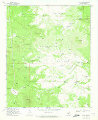
~ Jaycox Mtn AZ topo map, 1:24000 scale, 7.5 X 7.5 Minute, Historical, 1970, updated 1972
Jaycox Mtn , Arizona, USGS topographic map dated 1970.
Includes geographic coordinates (latitude and longitude). This topographic map is suitable for hiking, camping, and exploring, or framing it as a wall map.
Printed on-demand using high resolution imagery, on heavy weight and acid free paper, or alternatively on a variety of synthetic materials.
Topos available on paper, Waterproof, Poly, or Tyvek. Usually shipping rolled, unless combined with other folded maps in one order.
- Product Number: USGS-5553034
- Free digital map download (high-resolution, GeoPDF): Jaycox Mtn , Arizona (file size: 9 MB)
- Map Size: please refer to the dimensions of the GeoPDF map above
- Weight (paper map): ca. 55 grams
- Map Type: POD USGS Topographic Map
- Map Series: HTMC
- Map Verison: Historical
- Cell ID: 22445
- Scan ID: 311912
- Imprint Year: 1972
- Woodland Tint: Yes
- Aerial Photo Year: 1962
- Field Check Year: 1970
- Datum: NAD27
- Map Projection: Polyconic
- Map published by United States Geological Survey
- Map published by United States Forest Service
- Map Language: English
- Scanner Resolution: 600 dpi
- Map Cell Name: Jaycox Mountain
- Grid size: 7.5 X 7.5 Minute
- Date on map: 1970
- Map Scale: 1:24000
- Geographical region: Arizona, United States
Neighboring Maps:
All neighboring USGS topo maps are available for sale online at a variety of scales.
Spatial coverage:
Topo map Jaycox Mtn , Arizona, covers the geographical area associated the following places:
- Tower Tank - Hutch Tank - Jaycox Mountain - Grapevine Tank Number One - Gary David Tank - Fiftyfive Tank - Cow Hill Tank - Quarter Circle Bar Tank - Spring Tank - Lost Tank - Powerline Tank - Hard Luck Tank - Sixtytwo Tank - Cabin Tank - Dove Spring - Boondock Tank - Cow Hill - Grapevine Tank Number Two - Jaycox Tank - Sin Agua Tank - Johnny Tank - Snake Number Two Dam - Seven Gelding Tank - Indian Ruin Tank - Clay Tank - Open Draw Tank - Sixtyone Tank - Pine Spring - Fiftynine Tank - Section Twelve Tank - Snake Tank Number Two - Soldier Annex Canal - Bargaman Park - Snake Tank Number One - Kens Tank - JK Tank - Ruths Tank - Grapevine Spring - Sawmill Tanks - Doubtful Tank - Buss Tank - Pine Spring Tank - Pine Mountain - Rocky Bottom Tank - Luth Hart Tank - Wild Horse Tank - Bell Tank - Game and Fish Tank - Fiftyseven Tank - Butte Tank - Pine Tank - Sawmill Hills - Bargaman Park Tank - Dutch Tank - Sarah Jane Tank - Elk Tank - Quarter Corner Tank - Antelope Tank
- Map Area ID: AREA34.87534.75-111.375-111.25
- Northwest corner Lat/Long code: USGSNW34.875-111.375
- Northeast corner Lat/Long code: USGSNE34.875-111.25
- Southwest corner Lat/Long code: USGSSW34.75-111.375
- Southeast corner Lat/Long code: USGSSE34.75-111.25
- Northern map edge Latitude: 34.875
- Southern map edge Latitude: 34.75
- Western map edge Longitude: -111.375
- Eastern map edge Longitude: -111.25


