
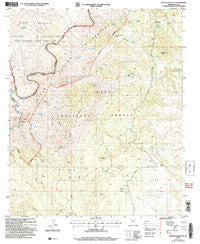
~ Haystack Butte AZ topo map, 1:24000 scale, 7.5 X 7.5 Minute, Historical, 2004, updated 2007
Haystack Butte, Arizona, USGS topographic map dated 2004.
Includes geographic coordinates (latitude and longitude). This topographic map is suitable for hiking, camping, and exploring, or framing it as a wall map.
Printed on-demand using high resolution imagery, on heavy weight and acid free paper, or alternatively on a variety of synthetic materials.
Topos available on paper, Waterproof, Poly, or Tyvek. Usually shipping rolled, unless combined with other folded maps in one order.
- Product Number: USGS-5552628
- Free digital map download (high-resolution, GeoPDF): Haystack Butte, Arizona (file size: 14 MB)
- Map Size: please refer to the dimensions of the GeoPDF map above
- Weight (paper map): ca. 55 grams
- Map Type: POD USGS Topographic Map
- Map Series: HTMC
- Map Verison: Historical
- Cell ID: 19833
- Scan ID: 311705
- Imprint Year: 2007
- Woodland Tint: Yes
- Aerial Photo Year: 2003
- Edit Year: 2004
- Survey Year: 1965
- Datum: NAD83
- Map Projection: Universal Transverse Mercator
- Map published by United States Geological Survey
- Map published by United States Forest Service
- Map Language: English
- Scanner Resolution: 600 dpi
- Map Cell Name: Haystack Butte
- Grid size: 7.5 X 7.5 Minute
- Date on map: 2004
- Map Scale: 1:24000
- Geographical region: Arizona, United States
Neighboring Maps:
All neighboring USGS topo maps are available for sale online at a variety of scales.
Spatial coverage:
Topo map Haystack Butte, Arizona, covers the geographical area associated the following places:
- Bronson Canyon - Barrel Spring - Brushy Spring - Hidden Tank - Pancho Spring - Blackjack Mountains - Shorty Camp Spring - Adobe Ranch - Nesbitt Spring - White Ledges - Sanders Spring - Monument Spring - Cottonwood Box Spring - Lower Corral Rapid - Headquarter Spring - Little Butte - Yankee Joe Tank - Bronson Spring - Hess Canyon - Yellowjacket Spring - Upper Corral Canyon - Haystack Butte - Black Mesa Tank - Haystack Butte Headquarters - Hess Creek - Brushy Spring - Yankee Joe Seep - Sedal Canyon - Little Butte Spring - Steer Tank - Butte Tank - J U Spring - Yankee Joe Canyon - Granite Spring - No Name Spring - Bronson Tank - Bear Cub Spring - Lower Corral Canyon - Willow Spring - Steer Pasture Well - Blackjack Wash - Clay Spring - Freezeout Spring - Black Mountain - Willow Spring - Little Walnut Spring - White Ledges Spring - Division Spring - Hackberry Spring - The Maze Rapid - Cottonwood Spring - Blackie Spring
- Map Area ID: AREA33.7533.625-110.75-110.625
- Northwest corner Lat/Long code: USGSNW33.75-110.75
- Northeast corner Lat/Long code: USGSNE33.75-110.625
- Southwest corner Lat/Long code: USGSSW33.625-110.75
- Southeast corner Lat/Long code: USGSSE33.625-110.625
- Northern map edge Latitude: 33.75
- Southern map edge Latitude: 33.625
- Western map edge Longitude: -110.75
- Eastern map edge Longitude: -110.625


