
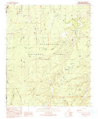
~ Hanks Draw AZ topo map, 1:24000 scale, 7.5 X 7.5 Minute, Historical, 1990, updated 1991
Hanks Draw, Arizona, USGS topographic map dated 1990.
Includes geographic coordinates (latitude and longitude). This topographic map is suitable for hiking, camping, and exploring, or framing it as a wall map.
Printed on-demand using high resolution imagery, on heavy weight and acid free paper, or alternatively on a variety of synthetic materials.
Topos available on paper, Waterproof, Poly, or Tyvek. Usually shipping rolled, unless combined with other folded maps in one order.
- Product Number: USGS-5552502
- Free digital map download (high-resolution, GeoPDF): Hanks Draw, Arizona (file size: 10 MB)
- Map Size: please refer to the dimensions of the GeoPDF map above
- Weight (paper map): ca. 55 grams
- Map Type: POD USGS Topographic Map
- Map Series: HTMC
- Map Verison: Historical
- Cell ID: 19194
- Scan ID: 311641
- Imprint Year: 1991
- Woodland Tint: Yes
- Aerial Photo Year: 1985
- Edit Year: 1990
- Field Check Year: 1987
- Datum: NAD27
- Map Projection: Transverse Mercator
- Provisional map: Yes
- Map published by United States Geological Survey
- Map Language: English
- Scanner Resolution: 600 dpi
- Map Cell Name: Hanks Draw
- Grid size: 7.5 X 7.5 Minute
- Date on map: 1990
- Map Scale: 1:24000
- Geographical region: Arizona, United States
Neighboring Maps:
All neighboring USGS topo maps are available for sale online at a variety of scales.
Spatial coverage:
Topo map Hanks Draw, Arizona, covers the geographical area associated the following places:
- Heber Work Center - Blind Tank - Broken Tank - Ellsworth Trick Tank - Crockett Tank - King Phillip Guzzler - Buckhorn Tank - Cross Tank - West Fork Hanks Draw - N-1 Canyon - Borrow Tank - Buckhorn Draw - Delodo Tank - Pot Hole Tank - Sharp Hollow Trick Tank - Heber YCC - Shelley Draw - Dolphin Tank - Kay Tank - Walnut Ranch - Reds Tank - Nelson Tanks - Wyrick Ranch - Walnut Canyon - Hanks Trick Tank - Upper Sharp Tank - Wildcat Spring - Hanks Draw - Deep Tank - Wheelbarrow Tank - Wyrick Ranch - Sponseller Tank - Cowboy Tank - North Fork Sharp Hollow - Delodo Draw - Porter Tank - Shipping Tank - Stermer Trick Tank - Clay Tank - Mud Tank - Black Mesa Ranger District - Little Nelson Lake - Little Wildcat Canyon - Sharp Hollow Tank - King Phillip Trick Tank - Heber Job Corp Conservation Center - Upper Turkey Tank - East Fork Hanks Draw - Wyrick Tank
- Map Area ID: AREA34.534.375-110.75-110.625
- Northwest corner Lat/Long code: USGSNW34.5-110.75
- Northeast corner Lat/Long code: USGSNE34.5-110.625
- Southwest corner Lat/Long code: USGSSW34.375-110.75
- Southeast corner Lat/Long code: USGSSE34.375-110.625
- Northern map edge Latitude: 34.5
- Southern map edge Latitude: 34.375
- Western map edge Longitude: -110.75
- Eastern map edge Longitude: -110.625


