
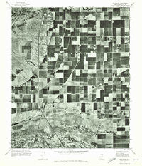
~ Guadalupe AZ topo map, 1:24000 scale, 7.5 X 7.5 Minute, Historical, 1971, updated 1972
Guadalupe, Arizona, USGS topographic map dated 1971.
Includes geographic coordinates (latitude and longitude). This topographic map is suitable for hiking, camping, and exploring, or framing it as a wall map.
Printed on-demand using high resolution imagery, on heavy weight and acid free paper, or alternatively on a variety of synthetic materials.
Topos available on paper, Waterproof, Poly, or Tyvek. Usually shipping rolled, unless combined with other folded maps in one order.
- Product Number: USGS-5552440
- Free digital map download (high-resolution, GeoPDF): Guadalupe, Arizona (file size: 18 MB)
- Map Size: please refer to the dimensions of the GeoPDF map above
- Weight (paper map): ca. 55 grams
- Map Type: POD USGS Topographic Map
- Map Series: HTMC
- Map Verison: Historical
- Cell ID: 18685
- Scan ID: 311609
- Imprint Year: 1972
- Aerial Photo Year: 1971
- Datum: NAD27
- Map Projection: Transverse Mercator
- Orthophoto: Quad
- Map published by United States Geological Survey
- Keywords: Nonstandard Press Run
- Map Language: English
- Scanner Resolution: 600 dpi
- Map Cell Name: Guadalupe
- Grid size: 7.5 X 7.5 Minute
- Date on map: 1971
- Map Scale: 1:24000
- Geographical region: Arizona, United States
Neighboring Maps:
All neighboring USGS topo maps are available for sale online at a variety of scales.
Spatial coverage:
Topo map Guadalupe, Arizona, covers the geographical area associated the following places:
- Tiburon - Suncrest Villas Chandler - Helena - Tempe Royal Palms - The Landings - Guadalupe - Camelot Luxury Homes - Pepperwood - Alta Mira - Ahwatukee - Central Ridge - Renaissance - Cambridge Heights - The Pointe at South Mountain - Village of Gila Springs - West Chandler - Continental Tempe - The Home Place - Kyrene - Silvergate Trails - Burgundy Hill - Parkside - The Lakes - Estates La Colina - Glenview Estates - Raintree - Los Tesoros - Desert Villas - Hightown - Orangetree - Dusk File - Crestview - Prado del Sol - Corona Village - Canyon Run - Raintree Luxury Homes - Heatherbrook
- Map Area ID: AREA33.37533.25-112-111.875
- Northwest corner Lat/Long code: USGSNW33.375-112
- Northeast corner Lat/Long code: USGSNE33.375-111.875
- Southwest corner Lat/Long code: USGSSW33.25-112
- Southeast corner Lat/Long code: USGSSE33.25-111.875
- Northern map edge Latitude: 33.375
- Southern map edge Latitude: 33.25
- Western map edge Longitude: -112
- Eastern map edge Longitude: -111.875


