
~ Greens Peak AZ topo map, 1:24000 scale, 7.5 X 7.5 Minute, Historical, 1997, updated 2000
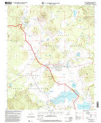
Greens Peak, Arizona, USGS topographic map dated 1997.
Includes geographic coordinates (latitude and longitude). This topographic map is suitable for hiking, camping, and exploring, or framing it as a wall map.
Printed on-demand using high resolution imagery, on heavy weight and acid free paper, or alternatively on a variety of synthetic materials.
Topos available on paper, Waterproof, Poly, or Tyvek. Usually shipping rolled, unless combined with other folded maps in one order.
- Product Number: USGS-5552390
- Free digital map download (high-resolution, GeoPDF): Greens Peak, Arizona (file size: 11 MB)
- Map Size: please refer to the dimensions of the GeoPDF map above
- Weight (paper map): ca. 55 grams
- Map Type: POD USGS Topographic Map
- Map Series: HTMC
- Map Verison: Historical
- Cell ID: 18424
- Scan ID: 311585
- Imprint Year: 2000
- Woodland Tint: Yes
- Aerial Photo Year: 1992
- Edit Year: 1997
- Survey Year: 1967
- Datum: NAD27
- Map Projection: Transverse Mercator
- Map published by United States Geological Survey
- Map published by United States Forest Service
- Map Language: English
- Scanner Resolution: 600 dpi
- Map Cell Name: Greens Peak
- Grid size: 7.5 X 7.5 Minute
- Date on map: 1997
- Map Scale: 1:24000
- Geographical region: Arizona, United States
Neighboring Maps:
All neighboring USGS topo maps are available for sale online at a variety of scales.
Spatial coverage:
Topo map Greens Peak, Arizona, covers the geographical area associated the following places:
- Fence Tank - Roadside Tank - Kessay Spring - Big Cienega Mountain - Greens Peak Lookout - Railroad Tank - Udall Draw Spring Number 1 - Sheep Cienega Campground - Snake Creek - Bighole Tank - Sheep Spring - Sherlock Draw Tank Number One - Fish Tank - Udall Park Tanks - Aspen Tank - Carnero Tank - Norton Reservoir - Sunnyside Reservoir - Halls Tank Number Three - Becker Spring - Snake Spring - White Mountain Dam - Draw Tank - Udall Draw Springs - Udall Park Spring - Sunrise Park - Dry Tank - Udall Park Tank - Sherlock Draw - Teal Sink - Sheep Camp Forest Service Facility - Swinborne Spring - Pole Knoll - White Mountain Reservoir - Sheep Tank - North Spring Tank - Ed Walker Tank - Sunnyside Dam - Middle Spring - Horse Camp Draw Springs - Seep Tank - Upper Spring - Beehive Spring Number Two - Big Meadows Tank Number Two - Sheep Springs Dam - Mac Spring - Udall Park - North Spring - Greens Peak - Big Meadows Tank Number One - Gadwell Sink - Loop Sink Number One - Bear Wallow Tank - Beehive Spring - Carnero Lake - Apache Spring - Becker Creek - Wooly Tank - Little Stock Tank - Carnero Spring - Pasture Tank - Sunrise Dam - Shipyard Tank - Natural Tank - Old Colter Ranch - Greens Peak Tank - Snake Creek Tank Number One - Draw Tank - 117 C Spring - Udall Park Spring Number 1 - Lost Spring - A One Lake - A One Dam - Sheep Camp Spring - Sunrise Lake - Smith Creek - A One Lake Campground - Sheep Spring Tank - Loop Sink Number Two - Sherlock Tank - CC Hall Spring - Swinbourne Tank - Sherlock Draw Tank Number Two - Horse Camp Draw - Grassy Tank - Green Tank - Border Sink - Norton Dam - Twin Spring - Struck Tank - Pothole Sink - Soldier Spring - Little Tank - Ord Creek - Geneva Reservoir
- Map Area ID: AREA34.12534-109.625-109.5
- Northwest corner Lat/Long code: USGSNW34.125-109.625
- Northeast corner Lat/Long code: USGSNE34.125-109.5
- Southwest corner Lat/Long code: USGSSW34-109.625
- Southeast corner Lat/Long code: USGSSE34-109.5
- Northern map edge Latitude: 34.125
- Southern map edge Latitude: 34
- Western map edge Longitude: -109.625
- Eastern map edge Longitude: -109.5


