
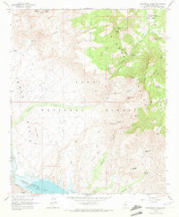
~ Greenback Creek AZ topo map, 1:24000 scale, 7.5 X 7.5 Minute, Historical, 1964, updated 1972
Greenback Creek, Arizona, USGS topographic map dated 1964.
Includes geographic coordinates (latitude and longitude). This topographic map is suitable for hiking, camping, and exploring, or framing it as a wall map.
Printed on-demand using high resolution imagery, on heavy weight and acid free paper, or alternatively on a variety of synthetic materials.
Topos available on paper, Waterproof, Poly, or Tyvek. Usually shipping rolled, unless combined with other folded maps in one order.
- Product Number: USGS-5552372
- Free digital map download (high-resolution, GeoPDF): Greenback Creek, Arizona (file size: 11 MB)
- Map Size: please refer to the dimensions of the GeoPDF map above
- Weight (paper map): ca. 55 grams
- Map Type: POD USGS Topographic Map
- Map Series: HTMC
- Map Verison: Historical
- Cell ID: 18368
- Scan ID: 311576
- Imprint Year: 1972
- Woodland Tint: Yes
- Aerial Photo Year: 1962
- Field Check Year: 1964
- Datum: NAD27
- Map Projection: Polyconic
- Map published by United States Geological Survey
- Map Language: English
- Scanner Resolution: 600 dpi
- Map Cell Name: Greenback Creek
- Grid size: 7.5 X 7.5 Minute
- Date on map: 1964
- Map Scale: 1:24000
- Geographical region: Arizona, United States
Neighboring Maps:
All neighboring USGS topo maps are available for sale online at a variety of scales.
Spatial coverage:
Topo map Greenback Creek, Arizona, covers the geographical area associated the following places:
- Conway Ranch - Blue Hills - Panther Mountain - Horse Range Mesa - Boneyback Peak - Willow Spring - Indian Point Recreation Site - Three Sisters Mountain - Saguaro Mine - Methodist Mountain - Yellow Jacket Spring - Methodist Mesa - Oak Spring - Salt Gulch Tank - Cactus Butte Spring - First Basin Tank - Blue Peak - Edwards Spring - Lime Springs - Red Blanket Peak - Salt Gulch - Journigan Mine - Journigan Spring - Blue Peak Canyon - Cactus Butte - Methodist Mesa Tank - Hackberry Spring - Bouquet Ranch - Devils Canyon - Jess Peak - San Carlos Tank - Panther Gulch - Cline Mesa - Greenback Valley - Salome Mountain - Schoolhouse Tank - Trick Tank - Twin Butte - Indian Point Campground - Half Moon Ridge - Panther Spring - Indian Point - Bumblebee Creek - Greenback Tank - Twin Butte Tank - Tonto Basin Ranger District - Cholla Tank - Victoria Peak - Glendale Point - Bluebird Mine
- Map Area ID: AREA33.87533.75-111.25-111.125
- Northwest corner Lat/Long code: USGSNW33.875-111.25
- Northeast corner Lat/Long code: USGSNE33.875-111.125
- Southwest corner Lat/Long code: USGSSW33.75-111.25
- Southeast corner Lat/Long code: USGSSE33.75-111.125
- Northern map edge Latitude: 33.875
- Southern map edge Latitude: 33.75
- Western map edge Longitude: -111.25
- Eastern map edge Longitude: -111.125


