
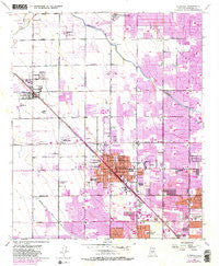
~ Glendale AZ topo map, 1:24000 scale, 7.5 X 7.5 Minute, Historical, 1957, updated 1983
Glendale, Arizona, USGS topographic map dated 1957.
Includes geographic coordinates (latitude and longitude). This topographic map is suitable for hiking, camping, and exploring, or framing it as a wall map.
Printed on-demand using high resolution imagery, on heavy weight and acid free paper, or alternatively on a variety of synthetic materials.
Topos available on paper, Waterproof, Poly, or Tyvek. Usually shipping rolled, unless combined with other folded maps in one order.
- Product Number: USGS-5552210
- Free digital map download (high-resolution, GeoPDF): Glendale, Arizona (file size: 14 MB)
- Map Size: please refer to the dimensions of the GeoPDF map above
- Weight (paper map): ca. 55 grams
- Map Type: POD USGS Topographic Map
- Map Series: HTMC
- Map Verison: Historical
- Cell ID: 17440
- Scan ID: 311495
- Imprint Year: 1983
- Woodland Tint: Yes
- Photo Revision Year: 1982
- Aerial Photo Year: 1978
- Edit Year: 1982
- Survey Year: 1957
- Datum: NAD27
- Map Projection: Universal Transverse Mercator
- Map published by United States Geological Survey
- Map Language: English
- Scanner Resolution: 600 dpi
- Map Cell Name: Glendale
- Grid size: 7.5 X 7.5 Minute
- Date on map: 1957
- Map Scale: 1:24000
- Geographical region: Arizona, United States
Neighboring Maps:
All neighboring USGS topo maps are available for sale online at a variety of scales.
Spatial coverage:
Topo map Glendale, Arizona, covers the geographical area associated the following places:
- Fairwood VIII - Bethany Grand Mobile Home Park - Royal Estates West - Palmaritas - Pioneer Village II - McCoy's Mobile Home Ranch - Paradise Grove Family Park - Glendale West Mobile Home Park - Windmill - Grand Missouri Adult Mobile Home Park - Dunhill Meadows - Westcliff Park - Shamrock Mobile Home Park - Deer Creek - Suncrest Mobile Home Park II - Phoenix West Mobile Home Park - San Miguel - Paradise Grove Trailer Park - Windsor Square - Greenbriar - Ironwood Terrace - Braemar VII - Cactus Gale V - Midges Court - Roles Inn of America - Santa Grande Mobile Home Park - Maryvale - Pepper Tree Mobile Home Park - Longhaven West - Montara - Long Haven West Mobile Home Park - Three Fountains - Peoria Palms Mobile Home Park - Fox Glen - Sunray Manor - Casa del Sol Resorts - Olive West - Westwind - Belaire Manor - Weedville - Glendale Cascade Mobile Home Park - Bethany Villa Adult Mobile Home Park - Village Park - Purple Sage Mobile Home Park - Blue Sky Mobile Estates - Thunderbird Palms II - Cottonwood Ranch - Westerra - Cheyenne Village - Bristol Square - Glendale - Triple T Mobilcity - Maryland West Mobile Home Park - Peoria - Flamingo Mobile Home Resort - Palm Shadows Mobile Home Park - Marlborough Meadows - Quail Lane - Lazy J Trailer Lodge - WillowBrook II - Shadow Ridge Mobile Home Park - Suncrest Mobile Home Park I - Casa Del Sol Resort East Mobile Home Park - The Citadel - Wellington Court - Rose Terrace Trailer Park - Indian Springs - Peoria Estates - Royal Glen Mobile Home Park - Santa Maria - Belaire Manor Mobile Home Park - Rambling Rons Mobile Home Park - Tiki Tai Village - Pensfield Place - Leisure Time Mobile Park - La Fontana Heights - Hoka Tiki Mobile Village - Mountain View Meadows - Sahara Mobile Home Park - Orange Grove Estates Mobile Home Park - Longhorn Ranch II - Desert Estates Mobile Home Park - Three Fountains Mobile Home Park
- Map Area ID: AREA33.62533.5-112.25-112.125
- Northwest corner Lat/Long code: USGSNW33.625-112.25
- Northeast corner Lat/Long code: USGSNE33.625-112.125
- Southwest corner Lat/Long code: USGSSW33.5-112.25
- Southeast corner Lat/Long code: USGSSE33.5-112.125
- Northern map edge Latitude: 33.625
- Southern map edge Latitude: 33.5
- Western map edge Longitude: -112.25
- Eastern map edge Longitude: -112.125


