
~ Explorers Monument AZ topo map, 1:24000 scale, 7.5 X 7.5 Minute, Historical, 1988, updated 1988
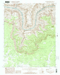
Explorers Monument, Arizona, USGS topographic map dated 1988.
Includes geographic coordinates (latitude and longitude). This topographic map is suitable for hiking, camping, and exploring, or framing it as a wall map.
Printed on-demand using high resolution imagery, on heavy weight and acid free paper, or alternatively on a variety of synthetic materials.
Topos available on paper, Waterproof, Poly, or Tyvek. Usually shipping rolled, unless combined with other folded maps in one order.
- Product Number: USGS-5551834
- Free digital map download (high-resolution, GeoPDF): Explorers Monument, Arizona (file size: 15 MB)
- Map Size: please refer to the dimensions of the GeoPDF map above
- Weight (paper map): ca. 55 grams
- Map Type: POD USGS Topographic Map
- Map Series: HTMC
- Map Verison: Historical
- Cell ID: 14746
- Scan ID: 311303
- Imprint Year: 1988
- Woodland Tint: Yes
- Aerial Photo Year: 1982
- Edit Year: 1988
- Field Check Year: 1985
- Datum: NAD27
- Map Projection: Transverse Mercator
- Provisional map: Yes
- Map published by United States Geological Survey
- Map Language: English
- Scanner Resolution: 600 dpi
- Map Cell Name: Explorers Monument
- Grid size: 7.5 X 7.5 Minute
- Date on map: 1988
- Map Scale: 1:24000
- Geographical region: Arizona, United States
Neighboring Maps:
All neighboring USGS topo maps are available for sale online at a variety of scales.
Spatial coverage:
Topo map Explorers Monument, Arizona, covers the geographical area associated the following places:
- Hidden Log Tank - Mount Huethawali - Montezuma Point - Stephen Aisle - Garnet Canyon - Mexican Jack Tank - Hundred and Twenty Mile Creek - Blacktail Canyon - Walthenberg Rapids - Elves Chasm - Conquistador Aisle - Royal Arch Creek - Walthenberg Canyon - Seep Spring - Hakatai Rapids - Darwin Plateau - Explorers Monument - Marcos Terrace - Fiske Butte - Chemehuevi Point - Spencer Terrace - Drummond Plateau - De Vaca Terrace - Toltec Point - Little Jim Tank - Apache Point - Big Jim Tank - Point Centeotl - Centeotl Point - Apache Terrace - Aztec Amphitheater - Point Huitzil - Hakatai Canyon - Point Quetzal - Mystic Spring - Royal Arch - Evolution Amphitheater - Pasture Wash Ranger Station
- Map Area ID: AREA36.2536.125-112.5-112.375
- Northwest corner Lat/Long code: USGSNW36.25-112.5
- Northeast corner Lat/Long code: USGSNE36.25-112.375
- Southwest corner Lat/Long code: USGSSW36.125-112.5
- Southeast corner Lat/Long code: USGSSE36.125-112.375
- Northern map edge Latitude: 36.25
- Southern map edge Latitude: 36.125
- Western map edge Longitude: -112.5
- Eastern map edge Longitude: -112.375


