
~ Cypress Butte AZ topo map, 1:24000 scale, 7.5 X 7.5 Minute, Historical, 2004, updated 2006
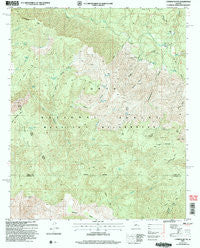
Cypress Butte, Arizona, USGS topographic map dated 2004.
Includes geographic coordinates (latitude and longitude). This topographic map is suitable for hiking, camping, and exploring, or framing it as a wall map.
Printed on-demand using high resolution imagery, on heavy weight and acid free paper, or alternatively on a variety of synthetic materials.
Topos available on paper, Waterproof, Poly, or Tyvek. Usually shipping rolled, unless combined with other folded maps in one order.
- Product Number: USGS-5551358
- Free digital map download (high-resolution, GeoPDF): Cypress Butte, Arizona (file size: 15 MB)
- Map Size: please refer to the dimensions of the GeoPDF map above
- Weight (paper map): ca. 55 grams
- Map Type: POD USGS Topographic Map
- Map Series: HTMC
- Map Verison: Historical
- Cell ID: 69809
- Scan ID: 311065
- Imprint Year: 2006
- Woodland Tint: Yes
- Aerial Photo Year: 2003
- Edit Year: 2004
- Survey Year: 1965
- Datum: NAD83
- Map Projection: Universal Transverse Mercator
- Map published by United States Geological Survey
- Map published by United States Forest Service
- Map Language: English
- Scanner Resolution: 600 dpi
- Map Cell Name: Cypress Butte
- Grid size: 7.5 X 7.5 Minute
- Date on map: 2004
- Map Scale: 1:24000
- Geographical region: Arizona, United States
Neighboring Maps:
All neighboring USGS topo maps are available for sale online at a variety of scales.
Spatial coverage:
Topo map Cypress Butte, Arizona, covers the geographical area associated the following places:
- Red Metal Spring - Midnight Mesa - Copper Mountain - Bull Trap Spring - Bull Spring Canyon - Bull Spring - Cottonwood Tank - Mazatzal Wilderness - Bull Spring Mesa - Bullfrog Ridge - Trail Spring - Bullfrog Spring - Rock Creek - Blackburn Tank - Knob Mountain - Limestone Hills - L F Ranch - Cedar Basin Spring - Houston Creek - Chalk Spring - Childers Spring - Polk Spring - Fuller Seep - Bullfrog Canyon - Clover Spring - Mine Road Spring - Red Metal Tank - Cedar Basin - Meteor Tank - Oak Thicket Spring - Cypress Butte - Brush Spring - Buffalo Canyon - Childers Seep - Tub Draw - Red Metal Canyon - Boardinghouse Canyon
- Map Area ID: AREA34.2534.125-111.625-111.5
- Northwest corner Lat/Long code: USGSNW34.25-111.625
- Northeast corner Lat/Long code: USGSNE34.25-111.5
- Southwest corner Lat/Long code: USGSSW34.125-111.625
- Southeast corner Lat/Long code: USGSSE34.125-111.5
- Northern map edge Latitude: 34.25
- Southern map edge Latitude: 34.125
- Western map edge Longitude: -111.625
- Eastern map edge Longitude: -111.5


