
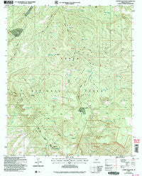
~ Copper Mountain AZ topo map, 1:24000 scale, 7.5 X 7.5 Minute, Historical, 2004, updated 2006
Copper Mountain, Arizona, USGS topographic map dated 2004.
Includes geographic coordinates (latitude and longitude). This topographic map is suitable for hiking, camping, and exploring, or framing it as a wall map.
Printed on-demand using high resolution imagery, on heavy weight and acid free paper, or alternatively on a variety of synthetic materials.
Topos available on paper, Waterproof, Poly, or Tyvek. Usually shipping rolled, unless combined with other folded maps in one order.
- Product Number: USGS-5551186
- Free digital map download (high-resolution, GeoPDF): Copper Mountain, Arizona (file size: 14 MB)
- Map Size: please refer to the dimensions of the GeoPDF map above
- Weight (paper map): ca. 55 grams
- Map Type: POD USGS Topographic Map
- Map Series: HTMC
- Map Verison: Historical
- Cell ID: 10048
- Scan ID: 310977
- Imprint Year: 2006
- Woodland Tint: Yes
- Aerial Photo Year: 2003
- Edit Year: 2004
- Survey Year: 1962
- Datum: NAD83
- Map Projection: Universal Transverse Mercator
- Map published by United States Geological Survey
- Map published by United States Forest Service
- Map Language: English
- Scanner Resolution: 600 dpi
- Map Cell Name: Copper Mountain
- Grid size: 7.5 X 7.5 Minute
- Date on map: 2004
- Map Scale: 1:24000
- Geographical region: Arizona, United States
Neighboring Maps:
All neighboring USGS topo maps are available for sale online at a variety of scales.
Spatial coverage:
Topo map Copper Mountain, Arizona, covers the geographical area associated the following places:
- Buckaroo Tank - Little Copper Mountain Tank - Cataract Canyon - Buck Peak - East Lacy Fork - West Copper Mountain Tank - Salome Creek - Jakes Tank Canyon - West Lacy Fork - McBride Tank - Greenback Peak - Big Turkey Tank - Indian Camp Canyon - Mud Spring - Thoroughbred Pasture Tank - Hells Hole - Little Turkey Creek - Cataract Tank - Copper Mountain Tank - Jerky Butte Tank - Headquarters Pasture Tank - Lookout Point - Little Turkey Tank - Dupont Canyon - Dupont Cabin - Long Mesa Tank - Indian Camp Reservoir - Copper Mountain - Rock Spring - Pine Flat Tank - Z T Ranch - Middle Mountain - Turkey Creek - Greenback Saddle Tank - Buckaroo Flats - Lion Spring - J R Ranch - Tonto Basin Division - Park Creek - Redman Mesa - Bear Head Canyon - Copper Mountain Points Tank - Turkey Creek - J Slash X Ranch - Peach Hollow Tank - J R Canyon - Workman Creek - Pine Mountain Tank - Dupont Tank - Elephant Corral Spring - Malicious Gap - Salt Log Canyon - Redman Mesa Tank
- Map Area ID: AREA3433.875-111.125-111
- Northwest corner Lat/Long code: USGSNW34-111.125
- Northeast corner Lat/Long code: USGSNE34-111
- Southwest corner Lat/Long code: USGSSW33.875-111.125
- Southeast corner Lat/Long code: USGSSE33.875-111
- Northern map edge Latitude: 34
- Southern map edge Latitude: 33.875
- Western map edge Longitude: -111.125
- Eastern map edge Longitude: -111


