
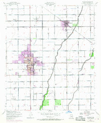
~ Chandler AZ topo map, 1:24000 scale, 7.5 X 7.5 Minute, Historical, 1952, updated 1968
Chandler, Arizona, USGS topographic map dated 1952.
Includes geographic coordinates (latitude and longitude). This topographic map is suitable for hiking, camping, and exploring, or framing it as a wall map.
Printed on-demand using high resolution imagery, on heavy weight and acid free paper, or alternatively on a variety of synthetic materials.
Topos available on paper, Waterproof, Poly, or Tyvek. Usually shipping rolled, unless combined with other folded maps in one order.
- Product Number: USGS-5550862
- Free digital map download (high-resolution, GeoPDF): Chandler, Arizona (file size: 7 MB)
- Map Size: please refer to the dimensions of the GeoPDF map above
- Weight (paper map): ca. 55 grams
- Map Type: POD USGS Topographic Map
- Map Series: HTMC
- Map Verison: Historical
- Cell ID: 8126
- Scan ID: 310808
- Imprint Year: 1968
- Woodland Tint: Yes
- Photo Revision Year: 1967
- Aerial Photo Year: 1967
- Field Check Year: 1952
- Datum: NAD27
- Map Projection: Polyconic
- Map published by United States Geological Survey
- Map published by United States Army Corps of Engineers
- Map published by United States Army
- Map Language: English
- Scanner Resolution: 600 dpi
- Map Cell Name: Chandler
- Grid size: 7.5 X 7.5 Minute
- Date on map: 1952
- Map Scale: 1:24000
- Geographical region: Arizona, United States
Neighboring Maps:
All neighboring USGS topo maps are available for sale online at a variety of scales.
Spatial coverage:
Topo map Chandler, Arizona, covers the geographical area associated the following places:
- A and F Trailer Court - Mission Valley - San Carlos - Breckenridge Manor - Womack East - Tremaine - Silvergate II - Chandler Gardens Mobile Home Park - Woodglen - Warner Park - Sunshine Valley Mobile Home Park - Esplanada - Sun Tech - Green Tree Mobile Home Park - Hacienda Solano Resort Mobile Home Park - Pozo - Kon Tiki Mobile Home Park - Chandler - The Haciendas - Casa Linda - Bridgeport - Amberwood - Legante Paseo - Brighton Place - The West Winds Trailer Court - San Tan Mobile Village - Sunridge IV - Evergreen Villa Mobile Home Park - Chandler Meadows Mobile Home Park - Colonial Coronita - Marlborough Mesa - Elmwood Trailer Park - Cedar Ridge - Stonegate Crossing - Valley Mobile Homes Estate - Dobson Ranch - Nortons Corner - Wishing Well Trailer Park - New Horizons - Sonora Town - Gilbert - Quail Place - Casas del Campo Mobile Home Park - Vista Alegre - Falfa - Hacienda Solano Park - Rancho de Chandler - Cloverleaf - Amberwood II
- Map Area ID: AREA33.37533.25-111.875-111.75
- Northwest corner Lat/Long code: USGSNW33.375-111.875
- Northeast corner Lat/Long code: USGSNE33.375-111.75
- Southwest corner Lat/Long code: USGSSW33.25-111.875
- Southeast corner Lat/Long code: USGSSE33.25-111.75
- Northern map edge Latitude: 33.375
- Southern map edge Latitude: 33.25
- Western map edge Longitude: -111.875
- Eastern map edge Longitude: -111.75


