
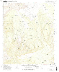
~ Cane Springs Mountain AZ topo map, 1:24000 scale, 7.5 X 7.5 Minute, Historical, 1967, updated 1985
Cane Springs Mountain, Arizona, USGS topographic map dated 1967.
Includes geographic coordinates (latitude and longitude). This topographic map is suitable for hiking, camping, and exploring, or framing it as a wall map.
Printed on-demand using high resolution imagery, on heavy weight and acid free paper, or alternatively on a variety of synthetic materials.
Topos available on paper, Waterproof, Poly, or Tyvek. Usually shipping rolled, unless combined with other folded maps in one order.
- Product Number: USGS-5550664
- Free digital map download (high-resolution, GeoPDF): Cane Springs Mountain, Arizona (file size: 10 MB)
- Map Size: please refer to the dimensions of the GeoPDF map above
- Weight (paper map): ca. 55 grams
- Map Type: POD USGS Topographic Map
- Map Series: HTMC
- Map Verison: Historical
- Cell ID: 7042
- Scan ID: 310715
- Imprint Year: 1985
- Woodland Tint: Yes
- Aerial Photo Year: 1965
- Field Check Year: 1967
- Datum: NAD27
- Map Projection: Polyconic
- Map published by United States Geological Survey
- Map Language: English
- Scanner Resolution: 600 dpi
- Map Cell Name: Cane Springs Mountain
- Grid size: 7.5 X 7.5 Minute
- Date on map: 1967
- Map Scale: 1:24000
- Geographical region: Arizona, United States
Neighboring Maps:
All neighboring USGS topo maps are available for sale online at a variety of scales.
Spatial coverage:
Topo map Cane Springs Mountain, Arizona, covers the geographical area associated the following places:
- Mineral Hill Tank - Brushy Mesa - Whiterock Spring - Greenhorn Canyon - Red Saddle Tank - The Gorge - Indian Spring Ridge - Greenhorn Tank - Cane Springs Mountain - Hells Neck Ridge - Taylor Tank - Whiterock Mesa - Alder Ridge - U A Tank - North Tank - Big Spring - Rock Tank - Hieroglyphic Tanks - Hieroglyphic Canyon - Grasshopper Tank - West Polles Tank - Saddle Corral - Saddle Ridge Pasture Tank - Bills Tank - Cane Springs Mountain Tank - Alder Tank - Wilderness Tank - Hardscrabble Mesa - L P Spring - Polles Tank - Bull Tank - Indian Spring - Indian Spring Canyon - Button Flat Tank - Squaw Basin Tank - Ross Tank - Plowbeam Tank - Bull Tank Mesa - Road Ridge - Saddle Ridge Tank - Middle Polles Tank - Hogan Ridge - Cane Spring - Bee Tree Tank - Saddle Ridge Pasture - Mogollon Rim - Trail Ridge - Black Jack Tank - Polles Mesa - Camp Gulch - Saddle Ridge - Cedar Bench - Twin Buttes - L P Canyon
- Map Area ID: AREA34.37534.25-111.625-111.5
- Northwest corner Lat/Long code: USGSNW34.375-111.625
- Northeast corner Lat/Long code: USGSNE34.375-111.5
- Southwest corner Lat/Long code: USGSSW34.25-111.625
- Southeast corner Lat/Long code: USGSSE34.25-111.5
- Northern map edge Latitude: 34.375
- Southern map edge Latitude: 34.25
- Western map edge Longitude: -111.625
- Eastern map edge Longitude: -111.5


