
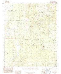
~ Camp Wood AZ topo map, 1:24000 scale, 7.5 X 7.5 Minute, Historical, 1986, updated 1986
Camp Wood, Arizona, USGS topographic map dated 1986.
Includes geographic coordinates (latitude and longitude). This topographic map is suitable for hiking, camping, and exploring, or framing it as a wall map.
Printed on-demand using high resolution imagery, on heavy weight and acid free paper, or alternatively on a variety of synthetic materials.
Topos available on paper, Waterproof, Poly, or Tyvek. Usually shipping rolled, unless combined with other folded maps in one order.
- Product Number: USGS-5550636
- Free digital map download (high-resolution, GeoPDF): Camp Wood, Arizona (file size: 10 MB)
- Map Size: please refer to the dimensions of the GeoPDF map above
- Weight (paper map): ca. 55 grams
- Map Type: POD USGS Topographic Map
- Map Series: HTMC
- Map Verison: Historical
- Cell ID: 6943
- Scan ID: 310700
- Imprint Year: 1986
- Woodland Tint: Yes
- Visual Version Number: 1
- Aerial Photo Year: 1980
- Edit Year: 1986
- Field Check Year: 1983
- Datum: NAD27
- Map Projection: Transverse Mercator
- Provisional map: Yes
- Map published by United States Geological Survey
- Map Language: English
- Scanner Resolution: 600 dpi
- Map Cell Name: Camp Wood
- Grid size: 7.5 X 7.5 Minute
- Date on map: 1986
- Map Scale: 1:24000
- Geographical region: Arizona, United States
Neighboring Maps:
All neighboring USGS topo maps are available for sale online at a variety of scales.
Spatial coverage:
Topo map Camp Wood, Arizona, covers the geographical area associated the following places:
- Pasture B Tank - Harmon Tank - Ranger Guard Station - Camp Wood Tank - Camp Wood Mountain Spring - Grapevine Spring - Hyde Creek Mountain - L O Spring - Stinson Wash - Brown Spring - Camp Wood Mountain - Connell Mountains - Santa Maria Mountains - Rock House Spring - Seven Up Ranch - Ruins Tank - Live Oak Well - Stinson Tank - Yolo Ranch - Pinetop Trick Tank - Carter Tank - Yolo Ranch Airport - Merritt Spring - Paddock Spring - Seven Up Spring - Pine Flats - Pinetop Tank - Rock Spring - Camp Wood Corner Tank - Paddock Ranch - Hyde Mountain Lookout Tower - Camp Wood Ranger Guard Station - Bear Trap Spring - Shivers Trap Spring - Pinetop Mountain - Apache Springs - Camp Wood - Granite Knob - Connell Gulch - Pasture Number Three Tank - Williamson Valley School - Bar Thirtyseven Ranch - Panther Spring - McElhaney Tank - Upper Hyde Spring - Hunt Tank - Connell Seep - Pine Spring - Camp Wood Corner Dam - Triangle HC Ranch - Snag Spring - Stinson Mountain
- Map Area ID: AREA34.87534.75-113-112.875
- Northwest corner Lat/Long code: USGSNW34.875-113
- Northeast corner Lat/Long code: USGSNE34.875-112.875
- Southwest corner Lat/Long code: USGSSW34.75-113
- Southeast corner Lat/Long code: USGSSE34.75-112.875
- Northern map edge Latitude: 34.875
- Southern map edge Latitude: 34.75
- Western map edge Longitude: -113
- Eastern map edge Longitude: -112.875


