
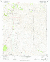
~ Cammerman Wash AZ topo map, 1:24000 scale, 7.5 X 7.5 Minute, Historical, 1966, updated 1978
Cammerman Wash, Arizona, USGS topographic map dated 1966.
Includes geographic coordinates (latitude and longitude). This topographic map is suitable for hiking, camping, and exploring, or framing it as a wall map.
Printed on-demand using high resolution imagery, on heavy weight and acid free paper, or alternatively on a variety of synthetic materials.
Topos available on paper, Waterproof, Poly, or Tyvek. Usually shipping rolled, unless combined with other folded maps in one order.
- Product Number: USGS-5550628
- Free digital map download (high-resolution, GeoPDF): Cammerman Wash, Arizona (file size: 9 MB)
- Map Size: please refer to the dimensions of the GeoPDF map above
- Weight (paper map): ca. 55 grams
- Map Type: POD USGS Topographic Map
- Map Series: HTMC
- Map Verison: Historical
- Cell ID: 6904
- Scan ID: 310696
- Imprint Year: 1978
- Woodland Tint: Yes
- Aerial Photo Year: 1964
- Field Check Year: 1966
- Datum: NAD27
- Map Projection: Polyconic
- Map published by United States Geological Survey
- Map Language: English
- Scanner Resolution: 600 dpi
- Map Cell Name: Cammerman Wash
- Grid size: 7.5 X 7.5 Minute
- Date on map: 1966
- Map Scale: 1:24000
- Geographical region: Arizona, United States
Neighboring Maps:
All neighboring USGS topo maps are available for sale online at a variety of scales.
Spatial coverage:
Topo map Cammerman Wash, Arizona, covers the geographical area associated the following places:
- C K Well - Gila County Fairgrounds - C K Tank - Butta Tank - Park Well - Quartzite Canyon - Ladd Tank - Champion Tank - State Highway District Headquarters - High Desert Middle School - Wheeler Landing Field (historical) - Corner Tank - Apache Spring - Scarborough Tank Number Two - Arizona State Highway Patrol Globe District 11 - Reservation Tank Number Two - Lewis Mill - Quartzite Peak - Cammerman Well - Jones Ranch - Mill Spring - Gilbert Well - Arizona State Highway District Headquarters - Cammerman Spring - West Double Dam - Hayes Tank - Trick Tank - Scarborough Tank Number One - Cammerman Wash - Champion Spring - Granite Butte - Park Tank
- Map Area ID: AREA33.533.375-110.75-110.625
- Northwest corner Lat/Long code: USGSNW33.5-110.75
- Northeast corner Lat/Long code: USGSNE33.5-110.625
- Southwest corner Lat/Long code: USGSSW33.375-110.75
- Southeast corner Lat/Long code: USGSSE33.375-110.625
- Northern map edge Latitude: 33.5
- Southern map edge Latitude: 33.375
- Western map edge Longitude: -110.75
- Eastern map edge Longitude: -110.625


