
~ Calloway Butte AZ topo map, 1:24000 scale, 7.5 X 7.5 Minute, Historical, 1965, updated 1972
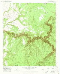
Calloway Butte, Arizona, USGS topographic map dated 1965.
Includes geographic coordinates (latitude and longitude). This topographic map is suitable for hiking, camping, and exploring, or framing it as a wall map.
Printed on-demand using high resolution imagery, on heavy weight and acid free paper, or alternatively on a variety of synthetic materials.
Topos available on paper, Waterproof, Poly, or Tyvek. Usually shipping rolled, unless combined with other folded maps in one order.
- Product Number: USGS-5550606
- Free digital map download (high-resolution, GeoPDF): Calloway Butte, Arizona (file size: 12 MB)
- Map Size: please refer to the dimensions of the GeoPDF map above
- Weight (paper map): ca. 55 grams
- Map Type: POD USGS Topographic Map
- Map Series: HTMC
- Map Verison: Historical
- Cell ID: 69526
- Scan ID: 310685
- Imprint Year: 1972
- Woodland Tint: Yes
- Aerial Photo Year: 1948
- Field Check Year: 1965
- Datum: NAD27
- Map Projection: Polyconic
- Map published by United States Geological Survey
- Map Language: English
- Scanner Resolution: 600 dpi
- Map Cell Name: Calloway Butte
- Grid size: 7.5 X 7.5 Minute
- Date on map: 1965
- Map Scale: 1:24000
- Geographical region: Arizona, United States
Neighboring Maps:
All neighboring USGS topo maps are available for sale online at a variety of scales.
Spatial coverage:
Topo map Calloway Butte, Arizona, covers the geographical area associated the following places:
- Pivot Rock Canyon - Wilbur Tank Number One - Ditch Tank - Sandy Tank - Harris Park - Tramway Tank - Soldier Mesa - Meadow Tank - Sams Butte - Hicks and Duncan Canyon - Between Tank - Dozer Tank - Willow Valley - Back Tank - Corral Tank - Island Tank - Wilbur Canyon - Bow Ribbon Tanks - Good Enough Tank - Scotts Tank - Maxwell Park - Dirty Name Tank - Oak Grove Tank - Toilet Paper Tank - Calloway Lake - Good Enough Ridge - Link Dart Tank - Walker Tank - Pecks Point Tank Number Three - Pecks Point Tank Number 3 - Horse Tank - Neilson Tank - Jack Pine Tank - Doghair Tank - Dukey Tank - Poor Tank - Calloway Butte - Twentyseven Mile Lake - Upper Tank - Island Tank - New Tank - Juniper Tank - Tule Tank - Bow Ribbon Park - Pecks Point Tank Number One - Bear Canyon - Wilbur Tank Number Two - Harris Tank - Bear Tank - Sams Butte Tank - Idas Tank - Orchard Grass Tank - Turkey Draw - Snake Tank - Pothole Tank - Pothole Tank - Toms Creek - Road Tank - Toms Tank - Horse Knoll Tank - Snake Ridge Tank - Snake Ridge - Rock Tank - West Tank - Maxwell Tank - Turkey Draw Tank - Flatrock Tank - Calloway Tank - Point Tank - Cave Draw Tank - Soldier Mesa Tank - Cherry Tree Tank - Bueno Tank - Clover Canyon - Clover Creek - Coyote Tank - Dead Horse Tank
- Map Area ID: AREA34.62534.5-111.5-111.375
- Northwest corner Lat/Long code: USGSNW34.625-111.5
- Northeast corner Lat/Long code: USGSNE34.625-111.375
- Southwest corner Lat/Long code: USGSSW34.5-111.5
- Southeast corner Lat/Long code: USGSSE34.5-111.375
- Northern map edge Latitude: 34.625
- Southern map edge Latitude: 34.5
- Western map edge Longitude: -111.5
- Eastern map edge Longitude: -111.375


