
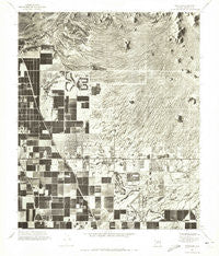
~ Buckhorn AZ topo map, 1:24000 scale, 7.5 X 7.5 Minute, Historical, 1971, updated 1972
Buckhorn, Arizona, USGS topographic map dated 1971.
Includes geographic coordinates (latitude and longitude). This topographic map is suitable for hiking, camping, and exploring, or framing it as a wall map.
Printed on-demand using high resolution imagery, on heavy weight and acid free paper, or alternatively on a variety of synthetic materials.
Topos available on paper, Waterproof, Poly, or Tyvek. Usually shipping rolled, unless combined with other folded maps in one order.
- Product Number: USGS-5550500
- Free digital map download (high-resolution, GeoPDF): Buckhorn, Arizona (file size: 13 MB)
- Map Size: please refer to the dimensions of the GeoPDF map above
- Weight (paper map): ca. 55 grams
- Map Type: POD USGS Topographic Map
- Map Series: HTMC
- Map Verison: Historical
- Cell ID: 5917
- Scan ID: 310627
- Imprint Year: 1972
- Aerial Photo Year: 1971
- Datum: NAD27
- Map Projection: Transverse Mercator
- Orthophoto: Quad
- Map published by United States Geological Survey
- Keywords: Nonstandard Press Run
- Map Language: English
- Scanner Resolution: 600 dpi
- Map Cell Name: Buckhorn
- Grid size: 7.5 X 7.5 Minute
- Date on map: 1971
- Map Scale: 1:24000
- Geographical region: Arizona, United States
Neighboring Maps:
All neighboring USGS topo maps are available for sale online at a variety of scales.
Spatial coverage:
Topo map Buckhorn, Arizona, covers the geographical area associated the following places:
- Sunshine Acres - Desert Vista Recreational Vehicle Resort - Park Place Mobile Home Park - New Hope Trailer Park - Pueblo Mesa Mobile Home Park - The Wells Mobile Home Park - Summer Mesa - Las Alegres - Dollbeer Mobile Home Ranch - Sunset Trail Ranch - Palmas del Sol - Mesa East Mobile Home Community - Royal Palm Village Mobile Home Park - Twin Knolls - Palmas Del Sol Mobile Home Park - Ciela Grande Mobile Home Park - Citrus Gardens - Juanita Mobile Home Park - Mesa Shadows East Mobile Home Park - Casa Serena Mobile Home Park - Leisure World - Granite Reef Estates - Greenfield Estates - Stewart Mountain Trailer Park - Silver Spur Ranch - Sunny Crest Mobile Home Park - Mesa Shadows Mobile Home Park - Harmony Villa - Trailing R Mobile Park - Sunset Trail Ranch Mobile Home Park - Buckhorn - Sunny Acres Trailer Village - Park Place Travel Resort - Pueblo Grande Mobile Home Park - Cactus Wren Mobile Park - Velda Rose Gardens - Hacienda de Valencia - Brentwood Southern Mobile Home Park - Desert Vista Estates III - Rancho at Val Vista Mobile Home Park - Sierra Estates Mobile Home Park - Fiesta Park - Crescent Run Mobile Home Park - Arizona Acres Mobile Home Resort - Lemontree - Las Palmas Mobile Home Park - Holiday Palms Mobile Home Park - Hacienda de Valencia Mobile Home Park - Fountain East - Velda Rose Estates - East Mesa - Dreamland Villa - Silver Spur Ranch Mobile Home Park - Rambler Mobile Park - Sunrise Village Mobile Home Park - Citrus Gardens Mobile Home Park - Silver Spur Village - Greenfield Park - Fountain of the Sun - Apache Wells - Superstition Country Subdivision - Venture Out - Twin Knolls Mobile Home Villa - Valle Del Oro Mobile Home Park - Royal Palm Village
- Map Area ID: AREA33.533.375-111.75-111.625
- Northwest corner Lat/Long code: USGSNW33.5-111.75
- Northeast corner Lat/Long code: USGSNE33.5-111.625
- Southwest corner Lat/Long code: USGSSW33.375-111.75
- Southeast corner Lat/Long code: USGSSE33.375-111.625
- Northern map edge Latitude: 33.5
- Southern map edge Latitude: 33.375
- Western map edge Longitude: -111.75
- Eastern map edge Longitude: -111.625


