
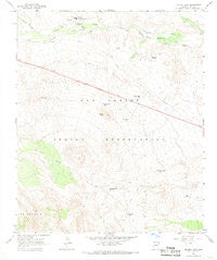
~ Bucket Mtn AZ topo map, 1:24000 scale, 7.5 X 7.5 Minute, Historical, 1965, updated 1968
Bucket Mtn, Arizona, USGS topographic map dated 1965.
Includes geographic coordinates (latitude and longitude). This topographic map is suitable for hiking, camping, and exploring, or framing it as a wall map.
Printed on-demand using high resolution imagery, on heavy weight and acid free paper, or alternatively on a variety of synthetic materials.
Topos available on paper, Waterproof, Poly, or Tyvek. Usually shipping rolled, unless combined with other folded maps in one order.
- Product Number: USGS-5550468
- Free digital map download (high-resolution, GeoPDF): Bucket Mtn, Arizona (file size: 9 MB)
- Map Size: please refer to the dimensions of the GeoPDF map above
- Weight (paper map): ca. 55 grams
- Map Type: POD USGS Topographic Map
- Map Series: HTMC
- Map Verison: Historical
- Cell ID: 5894
- Scan ID: 314425
- Imprint Year: 1968
- Woodland Tint: Yes
- Aerial Photo Year: 1964
- Field Check Year: 1965
- Datum: NAD27
- Map Projection: Polyconic
- Map published by United States Geological Survey
- Map Language: English
- Scanner Resolution: 600 dpi
- Map Cell Name: Bucket Mountain
- Grid size: 7.5 X 7.5 Minute
- Date on map: 1965
- Map Scale: 1:24000
- Geographical region: Arizona, United States
Neighboring Maps:
All neighboring USGS topo maps are available for sale online at a variety of scales.
Spatial coverage:
Topo map Bucket Mtn, Arizona, covers the geographical area associated the following places:
- Hagen Well - Narrows Tank - Dripping Springs Stockyard - Kinney Well - Bucket Mountain Tank - Bucket Mountain - Hog Mountain Dam - Gilson Well - East Bucket Mountain Dam - Hog Mountain Tanks - Dripping Springs - Chalk Tank - C K Canyon - Baxter Tank - Copper Mountain Dam - Gray Mare Tank - San Carlos Junior High School - Hog Mountain Dam Number Two - San Carlos Job Corporation Conservation Center - Copper Mountain Tank - Nelson Well - Bridge Washer Tank
- Map Area ID: AREA33.37533.25-110.625-110.5
- Northwest corner Lat/Long code: USGSNW33.375-110.625
- Northeast corner Lat/Long code: USGSNE33.375-110.5
- Southwest corner Lat/Long code: USGSSW33.25-110.625
- Southeast corner Lat/Long code: USGSSE33.25-110.5
- Northern map edge Latitude: 33.375
- Southern map edge Latitude: 33.25
- Western map edge Longitude: -110.625
- Eastern map edge Longitude: -110.5


