
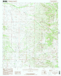
~ Bruno Peak AZ topo map, 1:24000 scale, 7.5 X 7.5 Minute, Historical, 1986, updated 1986
Bruno Peak, Arizona, USGS topographic map dated 1986.
Includes geographic coordinates (latitude and longitude). This topographic map is suitable for hiking, camping, and exploring, or framing it as a wall map.
Printed on-demand using high resolution imagery, on heavy weight and acid free paper, or alternatively on a variety of synthetic materials.
Topos available on paper, Waterproof, Poly, or Tyvek. Usually shipping rolled, unless combined with other folded maps in one order.
- Product Number: USGS-5550436
- Free digital map download (high-resolution, GeoPDF): Bruno Peak, Arizona (file size: 12 MB)
- Map Size: please refer to the dimensions of the GeoPDF map above
- Weight (paper map): ca. 55 grams
- Map Type: POD USGS Topographic Map
- Map Series: HTMC
- Map Verison: Historical
- Cell ID: 5795
- Scan ID: 310597
- Imprint Year: 1986
- Woodland Tint: Yes
- Visual Version Number: 2
- Aerial Photo Year: 1979
- Edit Year: 1986
- Field Check Year: 1981
- Datum: NAD27
- Map Projection: Transverse Mercator
- Map published by United States Geological Survey
- Map Language: English
- Scanner Resolution: 600 dpi
- Map Cell Name: Bruno Peak
- Grid size: 7.5 X 7.5 Minute
- Date on map: 1986
- Map Scale: 1:24000
- Geographical region: Arizona, United States
Neighboring Maps:
All neighboring USGS topo maps are available for sale online at a variety of scales.
Spatial coverage:
Topo map Bruno Peak, Arizona, covers the geographical area associated the following places:
- Willcox Tank - OK Ranch - Bar Boot Ranch - Devils Canyon Tank - Bower Tank - North Bruno Canyon - Lower Bruno Tank - Bruno Saddle - Bruno Canyon - Bruno Tank - Leslie Canyon National Wildlife Refuge - South Bruno Canyon - Boot Stock Tank - J Bar A Ranch - Rucker Cemetery - Winkler Tank - Warner Tank - Rucker School - Devils Canyon 237 - Glenn Tank - Hunt Canyon - Bruno Peak - Elfrida Division
- Map Area ID: AREA31.7531.625-109.5-109.375
- Northwest corner Lat/Long code: USGSNW31.75-109.5
- Northeast corner Lat/Long code: USGSNE31.75-109.375
- Southwest corner Lat/Long code: USGSSW31.625-109.5
- Southeast corner Lat/Long code: USGSSE31.625-109.375
- Northern map edge Latitude: 31.75
- Southern map edge Latitude: 31.625
- Western map edge Longitude: -109.5
- Eastern map edge Longitude: -109.375


