
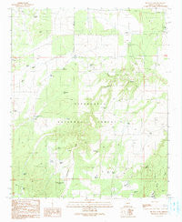
~ Big Pug Tank AZ topo map, 1:24000 scale, 7.5 X 7.5 Minute, Historical, 1990, updated 1991
Big Pug Tank, Arizona, USGS topographic map dated 1990.
Includes geographic coordinates (latitude and longitude). This topographic map is suitable for hiking, camping, and exploring, or framing it as a wall map.
Printed on-demand using high resolution imagery, on heavy weight and acid free paper, or alternatively on a variety of synthetic materials.
Topos available on paper, Waterproof, Poly, or Tyvek. Usually shipping rolled, unless combined with other folded maps in one order.
- Product Number: USGS-5550178
- Free digital map download (high-resolution, GeoPDF): Big Pug Tank, Arizona (file size: 9 MB)
- Map Size: please refer to the dimensions of the GeoPDF map above
- Weight (paper map): ca. 55 grams
- Map Type: POD USGS Topographic Map
- Map Series: HTMC
- Map Verison: Historical
- Cell ID: 72278
- Scan ID: 310459
- Imprint Year: 1991
- Woodland Tint: Yes
- Aerial Photo Year: 1985
- Edit Year: 1990
- Field Check Year: 1987
- Datum: NAD27
- Map Projection: Transverse Mercator
- Provisional map: Yes
- Map published by United States Geological Survey
- Map Language: English
- Scanner Resolution: 600 dpi
- Map Cell Name: Big Pug Tank
- Grid size: 7.5 X 7.5 Minute
- Date on map: 1990
- Map Scale: 1:24000
- Geographical region: Arizona, United States
Neighboring Maps:
All neighboring USGS topo maps are available for sale online at a variety of scales.
Spatial coverage:
Topo map Big Pug Tank, Arizona, covers the geographical area associated the following places:
- Ellsworth Tank - Cottonwood Number One Tank - Exchange Tank - XIL Tank - Lee Summers Tank - Flood Tank - Holy Oak Tank - Kays Tank - Walker Lake - Long Hollow Tank - Winter Tank - Hidden Tank - Jackrabbit Tank - Pitt Tank - Northwest Tank - Day Wash - Snowflake Landing - Woodland Tank - Government Tank - Dry Tank - Walker Well - New Tank - Pine Tank - Clay Springs Tank - Middle Tank - Upper Tank - Town Well - Section Twentyseven Tank - Cottonwood Number Two Tank - Lakeside Ranger District - Gressey Tank - Swale Tank - Number Four Trick Tank - Dalton Tank - Thomas Tank - Big Pug Tank - Little Pug Tank - Max Tank
- Map Area ID: AREA34.534.375-110.375-110.25
- Northwest corner Lat/Long code: USGSNW34.5-110.375
- Northeast corner Lat/Long code: USGSNE34.5-110.25
- Southwest corner Lat/Long code: USGSSW34.375-110.375
- Southeast corner Lat/Long code: USGSSE34.375-110.25
- Northern map edge Latitude: 34.5
- Southern map edge Latitude: 34.375
- Western map edge Longitude: -110.375
- Eastern map edge Longitude: -110.25


