
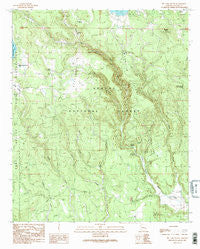
~ Big Lake South AZ topo map, 1:24000 scale, 7.5 X 7.5 Minute, Historical, 1991, updated 1991
Big Lake South, Arizona, USGS topographic map dated 1991.
Includes geographic coordinates (latitude and longitude). This topographic map is suitable for hiking, camping, and exploring, or framing it as a wall map.
Printed on-demand using high resolution imagery, on heavy weight and acid free paper, or alternatively on a variety of synthetic materials.
Topos available on paper, Waterproof, Poly, or Tyvek. Usually shipping rolled, unless combined with other folded maps in one order.
- Product Number: USGS-5550162
- Free digital map download (high-resolution, GeoPDF): Big Lake South, Arizona (file size: 14 MB)
- Map Size: please refer to the dimensions of the GeoPDF map above
- Weight (paper map): ca. 55 grams
- Map Type: POD USGS Topographic Map
- Map Series: HTMC
- Map Verison: Historical
- Cell ID: 3762
- Scan ID: 310451
- Imprint Year: 1991
- Woodland Tint: Yes
- Aerial Photo Year: 1984
- Edit Year: 1991
- Field Check Year: 1988
- Datum: NAD27
- Map Projection: Transverse Mercator
- Provisional map: Yes
- Map published by United States Geological Survey
- Map Language: English
- Scanner Resolution: 600 dpi
- Map Cell Name: Big Lake South
- Grid size: 7.5 X 7.5 Minute
- Date on map: 1991
- Map Scale: 1:24000
- Geographical region: Arizona, United States
Neighboring Maps:
All neighboring USGS topo maps are available for sale online at a variety of scales.
Spatial coverage:
Topo map Big Lake South, Arizona, covers the geographical area associated the following places:
- Fir Spring - Spillman Spring - Reservoir Tank - Boggy Pit Tank - Skin Spring Tank - South Tank - West Fork Forest Camp - Grayling Campground - Section 30 Tank - Deadman Crossing - House Tank - Center Fire Tank - Slade Spring - Upper Conklin Tank - Duck Lake Tank - Homestead Spring - Neck Tank - PN Spring - Apache Trout Campground - Section Thirteen Tank - Black Tank - Deadman Spring - OK Spring - Yes Tank - P S Knoll - Lou Tank - Blow Draw - Redondo Tank - Center Tank - Conklin Ridge - Merv Tank - Section Twenty-Eight Tank - Hayground Tank - Haygrounds - Lost Spring - Reservation Ranch - Upper Horse Tank Number One - Hay Creek Tank - Turkey Tank - Section Ten Tank - Slade Tank - Rainbow Campground - P S Knoll Lookout Tower - Section Fourteen Tank - Deer Tank - Railroad Loop Tank - Fence Pit Tank - Hay Creek - West Fork Campground - Reservation Tank - Big Lake Knoll - Colonel Spring Forest Camp - Center Tank - Section Sixteen Tank - Boggy Tank - East Draw Tank - Indian Spring - Home Creek Tank - Rail Spring - Larry Flat Tank - Duck Lake - Section Eleven Tank - Conklin Spring - Old Spring - Slide Draw Tank - Cienega Fourteen Tank - Hall Tank - Colonel Spring - Big Lake Lookout - Lower Hayground Tank - Section 26 Tank - Hayground Tank Number One - Home Creek - East Draw - Upper Horse Tank Number Two - Cutthroat Campground - Must Spring - Middle Prong Spring - Big Lake South Cove Boat Launch - Dry Tank - Lagoon Tank - 285 Tank - Resspass Tank - Fork Tank - Skin Spring Tank - Conklin Tank - P S Ranch
- Map Area ID: AREA33.87533.75-109.5-109.375
- Northwest corner Lat/Long code: USGSNW33.875-109.5
- Northeast corner Lat/Long code: USGSNE33.875-109.375
- Southwest corner Lat/Long code: USGSSW33.75-109.5
- Southeast corner Lat/Long code: USGSSE33.75-109.375
- Northern map edge Latitude: 33.875
- Southern map edge Latitude: 33.75
- Western map edge Longitude: -109.5
- Eastern map edge Longitude: -109.375


