
~ Battle Flat AZ topo map, 1:24000 scale, 7.5 X 7.5 Minute, Historical, 1974, updated 1982
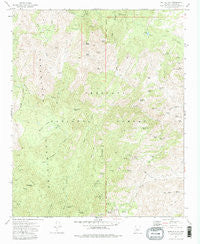
Battle Flat, Arizona, USGS topographic map dated 1974.
Includes geographic coordinates (latitude and longitude). This topographic map is suitable for hiking, camping, and exploring, or framing it as a wall map.
Printed on-demand using high resolution imagery, on heavy weight and acid free paper, or alternatively on a variety of synthetic materials.
Topos available on paper, Waterproof, Poly, or Tyvek. Usually shipping rolled, unless combined with other folded maps in one order.
- Product Number: USGS-5550076
- Free digital map download (high-resolution, GeoPDF): Battle Flat, Arizona (file size: 14 MB)
- Map Size: please refer to the dimensions of the GeoPDF map above
- Weight (paper map): ca. 55 grams
- Map Type: POD USGS Topographic Map
- Map Series: HTMC
- Map Verison: Historical
- Cell ID: 2656
- Scan ID: 310407
- Imprint Year: 1982
- Woodland Tint: Yes
- Aerial Photo Year: 1973
- Field Check Year: 1974
- Datum: NAD27
- Map Projection: Transverse Mercator
- Map published by United States Geological Survey
- Map Language: English
- Scanner Resolution: 600 dpi
- Map Cell Name: Battle Flat
- Grid size: 7.5 X 7.5 Minute
- Date on map: 1974
- Map Scale: 1:24000
- Geographical region: Arizona, United States
Neighboring Maps:
All neighboring USGS topo maps are available for sale online at a variety of scales.
Spatial coverage:
Topo map Battle Flat, Arizona, covers the geographical area associated the following places:
- Juniper Spring - Bucket Spring - Muldoon Gulch - SA Hill Trick Tank - Pine Flat - Mineral Creek Dam Tank - S A Hill - Arrastra Creek - De Soto Tank - Wire Spring - Deer Spring - Goat Ranch - Gold King Spring - Small Tank - Tuscumbia Mine - Tuscumbia Creek - Pine Creek - Wolf Creek Tank - Hidden Tunnel Spring - Granite Spring - T D Tank - Snake Track Tank - Stump Tank - Tuscumbia Mountain - The Troughs Spring - Mule Canyon - Buster Mine - Fence Tank - Blancho Spring - Wolf Creek - S A Tank - Skinner Tank - Bear Creek - Sandrock Spring - Poor Mans Spring - Middleton Creek - Turkey Spring - Coyote Tank - Black Rock Tank - Upper Spring - Peck Canyon - Brady Butte Tank - Muldoon Spring - Crooked Leg Tank - Mohawk Mine - Coyote Spring - Peck Mine - Battle Flat Trick Tank - Little Wolf Creek - Brushy Basin Spring - Battle Flat - Wild Flower Gulch - Lower Skinner Tank - Lower Mule Creek Spring - Cedar Tank - De Soto Mine - Brady Butte - West Side Trick Tank - Gold King Mine - Rocky Spring - Harl Tank - Bradshaw Trail - Boulder Dam Tank - Swastika Mine - Peck Spring - Hawkey Well - Upper Yellow Jacket Tank
- Map Area ID: AREA34.37534.25-112.375-112.25
- Northwest corner Lat/Long code: USGSNW34.375-112.375
- Northeast corner Lat/Long code: USGSNE34.375-112.25
- Southwest corner Lat/Long code: USGSSW34.25-112.375
- Southeast corner Lat/Long code: USGSSE34.25-112.25
- Northern map edge Latitude: 34.375
- Southern map edge Latitude: 34.25
- Western map edge Longitude: -112.375
- Eastern map edge Longitude: -112.25


