
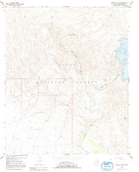
~ Bartlett Dam AZ topo map, 1:24000 scale, 7.5 X 7.5 Minute, Historical, 1964, updated 1992
Bartlett Dam, Arizona, USGS topographic map dated 1964.
Includes geographic coordinates (latitude and longitude). This topographic map is suitable for hiking, camping, and exploring, or framing it as a wall map.
Printed on-demand using high resolution imagery, on heavy weight and acid free paper, or alternatively on a variety of synthetic materials.
Topos available on paper, Waterproof, Poly, or Tyvek. Usually shipping rolled, unless combined with other folded maps in one order.
- Product Number: USGS-5550046
- Free digital map download (high-resolution, GeoPDF): Bartlett Dam, Arizona (file size: 10 MB)
- Map Size: please refer to the dimensions of the GeoPDF map above
- Weight (paper map): ca. 55 grams
- Map Type: POD USGS Topographic Map
- Map Series: HTMC
- Map Verison: Historical
- Cell ID: 2521
- Scan ID: 310389
- Imprint Year: 1992
- Woodland Tint: Yes
- Aerial Photo Year: 1962
- Field Check Year: 1964
- Datum: NAD27
- Map Projection: Polyconic
- Map published by United States Geological Survey
- Map Language: English
- Scanner Resolution: 600 dpi
- Map Cell Name: Bartlett Dam
- Grid size: 7.5 X 7.5 Minute
- Date on map: 1964
- Map Scale: 1:24000
- Geographical region: Arizona, United States
Neighboring Maps:
All neighboring USGS topo maps are available for sale online at a variety of scales.
Spatial coverage:
Topo map Bartlett Dam, Arizona, covers the geographical area associated the following places:
- Buckhorn Tank - Bartlett Reservoir - Bartlett Lake Marina - South Cove Recreation Site - Rattle Snake Cove Recreation Site - Bartlett Lake Recreation Site - Needle Rock Campground - Rattlesnake Cove Campground - Brushy Mountain - Bartlett Dam - Indian Spring Wash - Needle Rock - South Cove - Jojoba Boating Site - Camp Creek - Bootleg Canyon - Riverside Recreation Site - Bee Mountain - Bartlett Dam Heliport - Salt River Project Housing - Model A Tank - Rattlesnake Cove
- Map Area ID: AREA33.87533.75-111.75-111.625
- Northwest corner Lat/Long code: USGSNW33.875-111.75
- Northeast corner Lat/Long code: USGSNE33.875-111.625
- Southwest corner Lat/Long code: USGSSW33.75-111.75
- Southeast corner Lat/Long code: USGSSE33.75-111.625
- Northern map edge Latitude: 33.875
- Southern map edge Latitude: 33.75
- Western map edge Longitude: -111.75
- Eastern map edge Longitude: -111.625


