
~ Williams AZ topo map, 1:250000 scale, 1 X 2 Degree, Historical, 1956, updated 1963
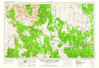
Williams, Arizona, USGS topographic map dated 1956.
Includes geographic coordinates (latitude and longitude). This topographic map is suitable for hiking, camping, and exploring, or framing it as a wall map.
Printed on-demand using high resolution imagery, on heavy weight and acid free paper, or alternatively on a variety of synthetic materials.
Topos available on paper, Waterproof, Poly, or Tyvek. Usually shipping rolled, unless combined with other folded maps in one order.
- Product Number: USGS-5549660
- Free digital map download (high-resolution, GeoPDF): Williams, Arizona (file size: 18 MB)
- Map Size: please refer to the dimensions of the GeoPDF map above
- Weight (paper map): ca. 55 grams
- Map Type: POD USGS Topographic Map
- Map Series: HTMC
- Map Verison: Historical
- Cell ID: 74971
- Scan ID: 315625
- Imprint Year: 1963
- Woodland Tint: Yes
- Edit Year: 1963
- Field Check Year: 1954
- Datum: Unstated
- Map Projection: Transverse Mercator
- Map published by United States Army Corps of Engineers
- Map published by United States Army
- Map Language: English
- Scanner Resolution: 600 dpi
- Map Cell Name: Williams
- Grid size: 1 X 2 Degree
- Date on map: 1956
- Map Scale: 1:250000
- Geographical region: Arizona, United States
Neighboring Maps:
All neighboring USGS topo maps are available for sale online at a variety of scales.
Spatial coverage:
Topo map Williams, Arizona, covers the geographical area associated the following places:
- Meath (historical) - Truxton - Robbers Roost - Pinaveta - Chalender - Walapai - Rose Well Camp - Bishop Place - Coconino - Quivero - Woodin - Hackberry - Ash Fork - Antares - Frazier Wells - Nelson - Valentine - Tin House - Butler - Crookton - Kaibab Mobile Home Park - Pine Tank - Apex - Williams Junction - Willaha - Williams - Seligman - Sereno Spring - Yampai - Pica - Bootlegger Crossing - Crozier - Berry - Audley - Daze - Valle - Grand Canyon Caverns - Sherwood Forest Estates - Corva - Sereno - Cucamonga Junction - Tusayan - Peach Springs
- Map Area ID: AREA3635-114-112
- Northwest corner Lat/Long code: USGSNW36-114
- Northeast corner Lat/Long code: USGSNE36-112
- Southwest corner Lat/Long code: USGSSW35-114
- Southeast corner Lat/Long code: USGSSE35-112
- Northern map edge Latitude: 36
- Southern map edge Latitude: 35
- Western map edge Longitude: -114
- Eastern map edge Longitude: -112


