
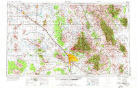
~ Tucson AZ topo map, 1:250000 scale, 1 X 2 Degree, Historical, 1956, updated 1973
Tucson, Arizona, USGS topographic map dated 1956.
Includes geographic coordinates (latitude and longitude). This topographic map is suitable for hiking, camping, and exploring, or framing it as a wall map.
Printed on-demand using high resolution imagery, on heavy weight and acid free paper, or alternatively on a variety of synthetic materials.
Topos available on paper, Waterproof, Poly, or Tyvek. Usually shipping rolled, unless combined with other folded maps in one order.
- Product Number: USGS-5549654
- Free digital map download (high-resolution, GeoPDF): Tucson, Arizona (file size: 21 MB)
- Map Size: please refer to the dimensions of the GeoPDF map above
- Weight (paper map): ca. 55 grams
- Map Type: POD USGS Topographic Map
- Map Series: HTMC
- Map Verison: Historical
- Cell ID: 69061
- Scan ID: 315610
- Imprint Year: 1973
- Woodland Tint: Yes
- Aerial Photo Year: 1956
- Edit Year: 1969
- Field Check Year: 1956
- Datum: Unstated
- Map Projection: Transverse Mercator
- Map published by United States Army Corps of Engineers
- Map published by United States Army
- Map Language: English
- Scanner Resolution: 600 dpi
- Map Cell Name: Tucson
- Grid size: 1 X 2 Degree
- Date on map: 1956
- Map Scale: 1:250000
- Geographical region: Arizona, United States
Neighboring Maps:
All neighboring USGS topo maps are available for sale online at a variety of scales.
Spatial coverage:
Topo map Tucson, Arizona, covers the geographical area associated the following places:
- Valley View - Foothills Mobile Home Park - Columbia Mobile Home Park - Shopishk - Adonis Mobile Home Subdivision - Mountain Vista Mobile Home Park - Diamond Grove Estates Mobile Home Park - Toltec - Lamplighter Mobile Home Park - Comobabi - Oracle Foothills Estates - Romero Trailer Estates - Wilmot - San Luis - Cardinal Lane Mobile Home Park - Skyline Bel Aire Estates - Silverlake Estates Mobile Home Park - Country Club Mobile Home Park - Shar I Don Trailer Park - Black Mountain Estates - El Molino Mobile Home Park - La Posada Trailer Park - Branding Iron Mobile Home Park - Los Ranchitos Mobile Home Park - Carefree Village Mobile Home Park - Eloy - Cielo Vista Mobile Home Park - Five Star Mobile Home Park - Rancho El Sol Mobile Home Park - Tucson - Friendly Corners - Picture Rocks - Desert Pueblo Mobile Home Park - Park West Mobile Homes Estates - Redington - Rancho Los Amigos Mobile Home Park - Loma Linda - Aravaipa - North Komelik - Village Mobile Home Park - Falcon Ridge Mobile Home Park - Eleven Mile Corner - Summerhaven - Double R Ranch Mobile Home Park - Coolidge - Terra Vista Estates Mobile Home Park - Sunwest Resort Mobile Home Park - Oracle - Covered Wagon Mobile Home Park - Littletown - Pueblo Gardens - Redwood Mobile Home Park - Old Tucson Estates - Cadillac Mobile Home Park - Stanfield - Hortons Place - Parsons Grove - Crossroads Mobile Home Park - Esmond - Rolling Hills Country Club Estates - Sunny Lane Mobile Home Park - Vista Del Norte Mobile Estates - Santa Cruz - Rillito - Summit - Gardner Estates - Pan Tak - Mission View Club Estates Mobile Home Park - Desert Sun Desert Winds Mobile Home Park - Noblesse Oblige Mobile Home Estates - Silver Cholla Mobile Park - Valle Vista Mobile Home Park - Emery Park - Catalina - Tiger - Red Rock - Catalina Country Manufatured Home Community - Rincon - Silver Bell - Jackrabbit House - Foothills West Resort Mobile Home Park - Makgum Havoka - Pipyak - Sunward Mobile Home Park - Colonial Mobile Homes Park - Hookers Hot Springs - Palm Vista Estates Mobile Home Park - Fairhaven Mobile Home Park - Mesa Ridge Mobile Home Park - Friendly Village Estates Mobile Home Park - Chuichu - Tanque Verde - Far Horizons East Mobile Home Park - Civano - Cammie's Foothills Vista Mobile Home Park - Orange Grove Mobile Estates - Far Horizons Trailer Village - Acacia Gardens Mobile Home Park - Laguna - Rankin
- Map Area ID: AREA3332-112-110
- Northwest corner Lat/Long code: USGSNW33-112
- Northeast corner Lat/Long code: USGSNE33-110
- Southwest corner Lat/Long code: USGSSW32-112
- Southeast corner Lat/Long code: USGSSE32-110
- Northern map edge Latitude: 33
- Southern map edge Latitude: 32
- Western map edge Longitude: -112
- Eastern map edge Longitude: -110


