
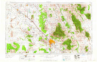
~ Tucson AZ topo map, 1:250000 scale, 1 X 2 Degree, Historical, 1959, updated 1959
Tucson, Arizona, USGS topographic map dated 1959.
Includes geographic coordinates (latitude and longitude). This topographic map is suitable for hiking, camping, and exploring, or framing it as a wall map.
Printed on-demand using high resolution imagery, on heavy weight and acid free paper, or alternatively on a variety of synthetic materials.
Topos available on paper, Waterproof, Poly, or Tyvek. Usually shipping rolled, unless combined with other folded maps in one order.
- Product Number: USGS-5549648
- Free digital map download (high-resolution, GeoPDF): Tucson, Arizona (file size: 19 MB)
- Map Size: please refer to the dimensions of the GeoPDF map above
- Weight (paper map): ca. 55 grams
- Map Type: POD USGS Topographic Map
- Map Series: HTMC
- Map Verison: Historical
- Cell ID: 69061
- Scan ID: 315607
- Imprint Year: 1959
- Woodland Tint: Yes
- Field Check Year: 1956
- Datum: Unstated
- Map Projection: Transverse Mercator
- Map published by United States Geological Survey
- Map Language: English
- Scanner Resolution: 600 dpi
- Map Cell Name: Tucson
- Grid size: 1 X 2 Degree
- Date on map: 1959
- Map Scale: 1:250000
- Geographical region: Arizona, United States
Neighboring Maps:
All neighboring USGS topo maps are available for sale online at a variety of scales.
Spatial coverage:
Topo map Tucson, Arizona, covers the geographical area associated the following places:
- Catalina Foothills - Desert Sun Desert Winds Mobile Home Park - Falcon Ridge Mobile Home Park - Mission View Club Estates Mobile Home Park - Valley Farms - Emery Park - Park West Mobile Homes Estates - Schuchk - Town and Country Mobile Home Park - Parkway Vista Mobile Home Park - Covered Wagon Mobile Home Park - Mammoth - Apache Village Trailer Park - Avra Valley - Civano - Cielo Vista Mobile Home Park - Hoi Oidak - Buffalo Mobile Home Park - Arizona Trailer Court - South Tucson - Kingston Knolls Terrace - Silverlake Estates Mobile Home Park - Oracle Foothills Estates - Casa Grande - Casa del Oro - San Pedro - Campo Bonito - Valle Vista Mobile Home Park - Campbell Estates Mobile Home Park - Oak Wells - Tucson Meadows Mobile Home Park - Three Points - Polvo - Redington - Swan Lake Estates Mobile Home Park - Far Horizons Mobile Home Park - Saddle Brooke - Branding Iron Mobile Home Park - Klondyke - Village Mobile Home Park - Drexel Heights - Cadillac Mobile Home Park - Leisure Village Mobile Home Park - Pima Ramada Mobile Home Park - Copper Creek - Terra Vista Estates Mobile Home Park - El Molino Mobile Home Park - Green Acres Mobile Home Park - Double R Ranch Mobile Home Park - Shar I Don Trailer Park - Noblesse Oblige Mobile Home Estates - Highjinks - Wymola - Cortaro - Casa Dulce Mobile Home Park - Diamond Grove Estates Mobile Home Park - Cascabel - Loma Linda - Tortolita - Amphitheater - Picture Rocks - Eloy - Silver Bell - Bermuda Gardens Trailer Park - Los Ranchitos Mobile Home Park - Hinsons Mobile Home Park - Gardner Mobile Home Estates - Soldier Camp - Redwood Mobile Home Park - Queens Well - Rincon - Arizonian Mobile Home Park - Orange Grove Estates - Marana - Indian Ridge Estates - Pipyak - Country Club Mobile Home Park - San Manuel - Black Mountain Estates - Shannon Trees Mobile Home Park - Flowing Wells - Summerhaven - Esmond - Las Casitas Mobile Home Park - Acacia Gardens Mobile Home Park - Rancho Los Amigos Mobile Home Park - Bon - Highlands Mobile Home Community - Cammie's Foothills Vista Mobile Home Park - Desert Classic Mobile Home Park - Fordville - Carousel Ranch Mobile Home Park - North Star Mobile Home Community - Kino - Mountain Vista Mobile Home Park - Brentwood Mobile Home Park - San Vicente - Tat Momoli - Summit - Far Horizons East Mobile Home Park
- Map Area ID: AREA3332-112-110
- Northwest corner Lat/Long code: USGSNW33-112
- Northeast corner Lat/Long code: USGSNE33-110
- Southwest corner Lat/Long code: USGSSW32-112
- Southeast corner Lat/Long code: USGSSE32-110
- Northern map edge Latitude: 33
- Southern map edge Latitude: 32
- Western map edge Longitude: -112
- Eastern map edge Longitude: -110


