
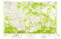
~ Saint Johns AZ topo map, 1:250000 scale, 1 X 2 Degree, Historical, 1958, updated 1958
Saint Johns, Arizona, USGS topographic map dated 1958.
Includes geographic coordinates (latitude and longitude). This topographic map is suitable for hiking, camping, and exploring, or framing it as a wall map.
Printed on-demand using high resolution imagery, on heavy weight and acid free paper, or alternatively on a variety of synthetic materials.
Topos available on paper, Waterproof, Poly, or Tyvek. Usually shipping rolled, unless combined with other folded maps in one order.
- Product Number: USGS-5549638
- Free digital map download (high-resolution, GeoPDF): Saint Johns, Arizona (file size: 18 MB)
- Map Size: please refer to the dimensions of the GeoPDF map above
- Weight (paper map): ca. 55 grams
- Map Type: POD USGS Topographic Map
- Map Series: HTMC
- Map Verison: Historical
- Cell ID: 69002
- Scan ID: 315586
- Imprint Year: 1958
- Woodland Tint: Yes
- Aerial Photo Year: 1954
- Field Check Year: 1954
- Datum: Unstated
- Map Projection: Transverse Mercator
- Map published by United States Geological Survey
- Map Language: English
- Scanner Resolution: 600 dpi
- Map Cell Name: Saint Johns
- Grid size: 1 X 2 Degree
- Date on map: 1958
- Map Scale: 1:250000
- Geographical region: Arizona, United States
Neighboring Maps:
All neighboring USGS topo maps are available for sale online at a variety of scales.
Spatial coverage:
Topo map Saint Johns, Arizona, covers the geographical area associated the following places:
- Sponseller - Grassie Place - Omega - Milky Ranch - White Mountain Lakes Estates - Lehew - Valle Redondo Trailer Park - Green Spot - Northwoods - Pinehill - Red Hill - Potter Place - Silver Creek - Heap Place - Lake of the Woods - Greer Place - Eagar - Bell - Adamana - Tres Lagunas - El Tule - Concho - Lakeside - Greens Gap - Los Burros - Richville - Salt Lake - Atarque - Pinetop - Correjo Crossing - Pinetop-Lakeside - Rosebud - Goodwater - Greer - Quemado - Tingle - Paulcell Place - Springerville - Fence Lake - Indian Pine - Saint Johns - Julian Place - White Mountain Lake - Vernon - Ojo Caliente - Techado - Homestead Mobile Home Park - Salado - Headquarters - Mangas - Hunt - Manuelito Place - Rainbow Lake Mobile Home Park - Hogg Place - Pie Town - Ubank Place - McNary - Running Bear Mobile Resort
- Map Area ID: AREA3534-110-108
- Northwest corner Lat/Long code: USGSNW35-110
- Northeast corner Lat/Long code: USGSNE35-108
- Southwest corner Lat/Long code: USGSSW34-110
- Southeast corner Lat/Long code: USGSSE34-108
- Northern map edge Latitude: 35
- Southern map edge Latitude: 34
- Western map edge Longitude: -110
- Eastern map edge Longitude: -108


