
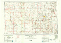
~ Prescott AZ topo map, 1:250000 scale, 1 X 2 Degree, Historical, 1959, updated 1959
Prescott, Arizona, USGS topographic map dated 1959.
Includes geographic coordinates (latitude and longitude). This topographic map is suitable for hiking, camping, and exploring, or framing it as a wall map.
Printed on-demand using high resolution imagery, on heavy weight and acid free paper, or alternatively on a variety of synthetic materials.
Topos available on paper, Waterproof, Poly, or Tyvek. Usually shipping rolled, unless combined with other folded maps in one order.
- Product Number: USGS-5549622
- Free digital map download (high-resolution, GeoPDF): Prescott, Arizona (file size: 14 MB)
- Map Size: please refer to the dimensions of the GeoPDF map above
- Weight (paper map): ca. 55 grams
- Map Type: POD USGS Topographic Map
- Map Series: HTMC
- Map Verison: Historical
- Cell ID: 74966
- Scan ID: 315573
- Imprint Year: 1959
- Aerial Photo Year: 1940
- Datum: NAD27
- Map Projection: Transverse Mercator
- Map published by United States Army Corps of Engineers
- Map published by United States Army
- Map Language: English
- Scanner Resolution: 600 dpi
- Map Cell Name: Prescott
- Grid size: 1 X 2 Degree
- Date on map: 1959
- Map Scale: 1:250000
- Geographical region: Arizona, United States
Neighboring Maps:
All neighboring USGS topo maps are available for sale online at a variety of scales.
Spatial coverage:
Topo map Prescott, Arizona, covers the geographical area associated the following places:
- Jerome - Pine Lawn Ranch Mobile Home Park - P and E Junction - Humboldt - Verde Village - Congress Junction - Flores - Venezia - Copperopolis - Hillside - South Fort - Walker - Baldwin Place - Centerville - Paxton Place - Rock Springs - Wildwood Estates - Walnut Grove - Whipple - Drake - Prescott Valley - Rush Place Windmill - Mint - Black Canyon City - Alamo Crossing (historical) - Pine Haven Mobile Home Park - Cordes - Bumble Bee - Ponderosa Park - Iron Springs Manor Mobile Home Park - Swansea - Tutt - Minnehaha - Six Mile Crossing - Oak Knoll Village - Prescott Gardens Mobile Home Park - Granite Siding - Diamond Valley - Stanton - Stringfield - Country West Mobile Home Park - Fort Misery - Wikieup - Chilean Mill - Yavapai Hills - Lapham - Skull Valley - Willow Spring - McNary Place - Cottonwood - Bear - Burro John - Williamson - Wilhoit - Greenwood - Tapco - Grand View - Signal - East Fort - Ocotillo - Entro - White Cloud Mobile Home Park - Iron Springs - Piedmont - Kirkland Junction - Dewey - Shadow Mountain Mobile Home Park - Highland Park - Bagdad - Glen Ilah - Clemenceau - Beverly Gardens Trailer Park - Walker Place Windmill - Groom Creek - Forbing Park - Lehman Mill - Apron Crossing - Arcosanti - Breezy Pines - Gillette - Heritage Mobile Home Park - Eddy Place - Cherry - Prescott - Sycamore - Bradshaw City - Canyon Retreat Mobile Home Park - Sand Mill - Castle Canyon Mesa - Humbug - Yarnell - Deering Park Estates - Paulden - Shady Acres Mobile Park - Ferguson Place Windmill - Nothing (historical) - Fort Whipple - Blue Hills Farms - Hawkins - Tip Top (historical)
- Map Area ID: AREA3534-114-112
- Northwest corner Lat/Long code: USGSNW35-114
- Northeast corner Lat/Long code: USGSNE35-112
- Southwest corner Lat/Long code: USGSSW34-114
- Southeast corner Lat/Long code: USGSSE34-112
- Northern map edge Latitude: 35
- Southern map edge Latitude: 34
- Western map edge Longitude: -114
- Eastern map edge Longitude: -112


