
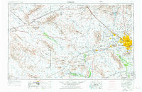
~ Phoenix AZ topo map, 1:250000 scale, 1 X 2 Degree, Historical, 1954, updated 1976
Phoenix, Arizona, USGS topographic map dated 1954.
Includes geographic coordinates (latitude and longitude). This topographic map is suitable for hiking, camping, and exploring, or framing it as a wall map.
Printed on-demand using high resolution imagery, on heavy weight and acid free paper, or alternatively on a variety of synthetic materials.
Topos available on paper, Waterproof, Poly, or Tyvek. Usually shipping rolled, unless combined with other folded maps in one order.
- Product Number: USGS-5549620
- Free digital map download (high-resolution, GeoPDF): Phoenix, Arizona (file size: 16 MB)
- Map Size: please refer to the dimensions of the GeoPDF map above
- Weight (paper map): ca. 55 grams
- Map Type: POD USGS Topographic Map
- Map Series: HTMC
- Map Verison: Historical
- Cell ID: 74961
- Scan ID: 315571
- Imprint Year: 1976
- Woodland Tint: Yes
- Aerial Photo Year: 1953
- Edit Year: 1969
- Field Check Year: 1954
- Datum: Unstated
- Map Projection: Transverse Mercator
- Map published by: Military, Other
- Map Language: English
- Scanner Resolution: 600 dpi
- Map Cell Name: Phoenix
- Grid size: 1 X 2 Degree
- Date on map: 1954
- Map Scale: 1:250000
- Geographical region: Arizona, United States
Neighboring Maps:
All neighboring USGS topo maps are available for sale online at a variety of scales.
Spatial coverage:
Topo map Phoenix, Arizona, covers the geographical area associated the following places:
- Byrds Mobile Home Park - Shadow Ridge Mobile Home Park - Thunderbird Valley Number Two - Liberty Mobile Home Park - Orange Grove Estates Mobile Home Park - Bristol Square - S C Townhouse Mobile Home Estates - Montezuma - Covered Wagon Mobile Home Park - Brenda - Bethany Villa Adult Mobile Home Park - Desert Valley Estates - Sun Grove Mobile Home Park - La Montana del Sur - Casa del Sol Resorts - Seven Palms Mobile Home Estates - Chaparral - Wigwam Villa Mobile Home Park - Peacock Village - Sleepy Hollow Trailer Village - Deer Valley - Thomas Trailer Court - West End - San Gabriel - Arrowhead Ranch - Lone Butte Ranch - Adobe - Wickenburg - Turf Mobile Manor - Country Home Mobile Village - Desert Estates Mobile Home Park - Wild Flower - Silver Bell Trailer Park (historical) - Sunburst Homes - Santa Cruz - Villa Vista Mobile Home Park - Phoenix Acres Trailer Park - Valley View - LaLoma Ranch - Waddell - Chapparal Mobile Village - El San Juan Trailer Park - Sunrise Terrace - Litchfield Junction - Allenville - Peoria Polynesian Village Mobile Home Park - Mayflower Terrace - Westpark Mobile Home Park - La Montana Del Sur Mobile Home Park - Hidden Acres Mobile Home Park - Perryville - Rancho Encanto - Lazy Daze Mobile Home Park - Paradise Valley Mobilhome Park - Rancho San Carlos - WillowBrook II - Parkview North - Turtle Creek - Shadow Hills Mobile Home Park - Rancho Hermoso - Steeplechase - Tonopah - Morado Encanto - Desert Sands Mobile Home Park - Desert Cypress Trailer Ranch - Villa Vista - Sunray Manor - Villas Plaza - Santa Maria - Lexington Place - Wranglers Roost - Cartwright - Thunderbird Palms II - Sheffield Place - Orangewood Village Mobilehome Park - Union Hills Manor - Arbor Manor Mobile Home Park - Casa de Francisco Mobile Home Park - Phoenix - Parkwood - Sunset North - Cataline Village Mobile Home Park - Peoria Estates - Whispering Palms Mobile Home Park - Lake Biltmore Estates - Blue Sky Mobile Estates - Palms Trailer Park - Eighteen Bells Mobile Home Park - Dixie - Country Greens at Villa de Paz - Braemar VII - Welcome Home Mobile Park - The Palms of El Mirage Mobile Home Park - Royal Palm Travel Trailer and Mobile Home Park - Wellington Court - Estrella Villa Mobile Home Park - Maricopa - Saint Johns Mission - El Mirage - Central Park Village Mobile Home Park
- Map Area ID: AREA3433-114-112
- Northwest corner Lat/Long code: USGSNW34-114
- Northeast corner Lat/Long code: USGSNE34-112
- Southwest corner Lat/Long code: USGSSW33-114
- Southeast corner Lat/Long code: USGSSE33-112
- Northern map edge Latitude: 34
- Southern map edge Latitude: 33
- Western map edge Longitude: -114
- Eastern map edge Longitude: -112


