
~ Phoenix AZ topo map, 1:250000 scale, 1 X 2 Degree, Historical, 1954, updated 1974
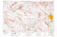
Phoenix, Arizona, USGS topographic map dated 1954.
Includes geographic coordinates (latitude and longitude). This topographic map is suitable for hiking, camping, and exploring, or framing it as a wall map.
Printed on-demand using high resolution imagery, on heavy weight and acid free paper, or alternatively on a variety of synthetic materials.
Topos available on paper, Waterproof, Poly, or Tyvek. Usually shipping rolled, unless combined with other folded maps in one order.
- Product Number: USGS-5549614
- Free digital map download (high-resolution, GeoPDF): Phoenix, Arizona (file size: 17 MB)
- Map Size: please refer to the dimensions of the GeoPDF map above
- Weight (paper map): ca. 55 grams
- Map Type: POD USGS Topographic Map
- Map Series: HTMC
- Map Verison: Historical
- Cell ID: 74961
- Scan ID: 315568
- Imprint Year: 1974
- Woodland Tint: Yes
- Edit Year: 1969
- Field Check Year: 1954
- Datum: Unstated
- Map Projection: Transverse Mercator
- Map published by United States Army Corps of Engineers
- Map published by United States Army
- Map Language: English
- Scanner Resolution: 600 dpi
- Map Cell Name: Phoenix
- Grid size: 1 X 2 Degree
- Date on map: 1954
- Map Scale: 1:250000
- Geographical region: Arizona, United States
Neighboring Maps:
All neighboring USGS topo maps are available for sale online at a variety of scales.
Spatial coverage:
Topo map Phoenix, Arizona, covers the geographical area associated the following places:
- Peoria Estates - Lizard Acres - Bel-Aire Trailer Park - Co-op Village - Cartwright - Villa Vista - Cashion - Santa Maria - Roles Inn of America - Cactus - Dixie - Broadway Trailer Court - Fox Glen - Castle Hot Springs - Boulder Ridge Mobile Home Park - Salome - Aguila - Country Greens at Villa de Paz - Engesser Junction - Estrella Camp - New River - Cottonwood Ranch - Taliverde - Centura West - Thunderbird Valley Number Two - Circle City - Flamingo Mobile Home Resort - Waddell - Sun Trailer Park - Plaza Trailer Inn - Cactus Ranch Trailer Court - Western Palms Mobile Home Community - Olive West - Rose Garden Mobile Home Resort - Grandview Mobile Home Park - Vicksburg Junction - Westcliff Park - Rancho Hermoso - Oregon Trail Mobile Home Park - Harcuvar - Fairwood VIII - Canyon View - Purple Sage Mobile Home Park - Mountain Gate Mobile Home Park - Lexington Place - Peoria Palms Mobile Home Park - Big Reef Mill - Sunset Vista - Washington Trailer Park - Long Haven West Mobile Home Park - The Preserve - Enid - Saddle - Palmaritas - Squaw Peak Terrace - Alhambra - Bethany Villa Adult Mobile Home Park - The Palms of El Mirage Mobile Home Park - Mountain Vista - Sundad - Country Meadows - Youngtown - Estrella Estates Family Park - Rollin W Mobile Home Ranch - Valencia - Rancho San Carlos - Fowler - Shadow Hills Mobile Home Park - Tiki Tai Village - Country Villa Mobile Home Park - Palm West Mobile Home Park - Legend Estates - Sunrise Terrace - Lone Butte Ranch - Sun Valley Trailer Park - Wranglers Roost - Rambling Rons Mobile Home Park - Mountain View Meadows - Rainbow Valley - Bona Venture Mobile Home Park - Sunset Village - Goldbadge - Country Manor Mobile Home Park - Desert Cypress Trailer Ranch - Deer Valley - Turf Trailer Lodge - Braemar VII - Chris-Town Travel Trailer and Mobile Home Park - Palm Drive Trailer Ranch - DeLuxe Trailer Court - Phoenix Mobile Home Park - Palo Verde Mobile Home and Recreational Vehicle Park - Central Park Village - Villa Novena - Biltmore Greens III - Longhorn Ranch II - Estate Monterra - Blue Sky Mobile Estates - Heritage Highlands - Quail Lane
- Map Area ID: AREA3433-114-112
- Northwest corner Lat/Long code: USGSNW34-114
- Northeast corner Lat/Long code: USGSNE34-112
- Southwest corner Lat/Long code: USGSSW33-114
- Southeast corner Lat/Long code: USGSSE33-112
- Northern map edge Latitude: 34
- Southern map edge Latitude: 33
- Western map edge Longitude: -114
- Eastern map edge Longitude: -112


