
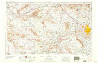
~ Phoenix AZ topo map, 1:250000 scale, 1 X 2 Degree, Historical, 1958, updated 1958
Phoenix, Arizona, USGS topographic map dated 1958.
Includes geographic coordinates (latitude and longitude). This topographic map is suitable for hiking, camping, and exploring, or framing it as a wall map.
Printed on-demand using high resolution imagery, on heavy weight and acid free paper, or alternatively on a variety of synthetic materials.
Topos available on paper, Waterproof, Poly, or Tyvek. Usually shipping rolled, unless combined with other folded maps in one order.
- Product Number: USGS-5549608
- Free digital map download (high-resolution, GeoPDF): Phoenix, Arizona (file size: 17 MB)
- Map Size: please refer to the dimensions of the GeoPDF map above
- Weight (paper map): ca. 55 grams
- Map Type: POD USGS Topographic Map
- Map Series: HTMC
- Map Verison: Historical
- Cell ID: 74961
- Scan ID: 315565
- Imprint Year: 1958
- Field Check Year: 1954
- Datum: Unstated
- Map Projection: Transverse Mercator
- Map published by United States Army Corps of Engineers
- Map published by United States Army
- Map Language: English
- Scanner Resolution: 600 dpi
- Map Cell Name: Phoenix
- Grid size: 1 X 2 Degree
- Date on map: 1958
- Map Scale: 1:250000
- Geographical region: Arizona, United States
Neighboring Maps:
All neighboring USGS topo maps are available for sale online at a variety of scales.
Spatial coverage:
Topo map Phoenix, Arizona, covers the geographical area associated the following places:
- Sahara Mobile Home Park - Citrus Grove Trailer Park - Country West Mobile Home Park - Beardsley - Casa del Sol Resorts - Sunset Village - San Miguel - Pecan Grove Trailer Park - Quail Lane - McVay - Wickenburg - Skyline Heights - Pecan Tree Park Mobile Home Park - Deer Valley - Citrus Park - Colony South - College Park - The Citadel - Valley Gardens Trailer Park - Ironwood Terrace - South Phoenix - Washington Trailer Park - Pioneer Village II - Whispering Palms Mobile Home Park - Liberty Mobile Home Park - Villa Vista - Fox Glen - Tiki Tai Village - Green Valley Trailer Park - Blue Bell Mobile Home Park - Goodyear - Woodridge VI - New Hope - Bonaventure Mobile Home Community - Lazy Daze Mobile Home Park - South Mountain Trailer Park - Wayne - Trail-R-Dale Mobile Home Park - Hyder - Paradise Valley Mobilhome Park - Autumn Ridge - Country Meadows - Liberty Village - Komatke - Lizard Acres - Maricopa Village - Westridge Park - Royal Glen Mobile Home Park - Cactus - Bell Casas Mobile Home Estates - Webb - Country Ridge - Sunset North - Perryville - Fowler - El Mirage - Palm Shadows Mobile Home Park - Estrella - Laveen - Arlington - Big Reef Mill - Turf Mobile Manor - Casa Del Sol Resort East Mobile Home Park - Country Hills Mobile Estates - Desert Gem Mobile Home Park - Shamrock Mobile Home Park - Rancho San Carlos - Rancho Encanto - Green Acres Mobile and Recreational Vehicle Park - Engesser Junction - Turtle Creek - Pioneer - Biltmore Gates - Rose Garden Place - Brandywine - Pioneer Estates - Estrella Shadows Mobile Home Park - Bristol Square - Centura West - Greentrails - Chris-Town Travel Trailer and Mobile Home Park - Sky Ridge Mobile Homes - Desert Wells - Hassayampa - Taliverde - Casa Del Sol Resort West Mobile Home Park - Glen Canyon Trailer Park - Arbor Manor Mobile Home Park - Wittmann - Ambrosia Mill - Vicksburg - Country Greens at Villa de Paz - Sunscape Homes - Holiday Spa Mobile Home Park - Mobile Gardens Mobile Home Park - Orange Grove Estates Mobile Home Park - Sheffield Place - Rosewood Estates Mobile Home Park - Wranglers Roost - Agua Fria
- Map Area ID: AREA3433-114-112
- Northwest corner Lat/Long code: USGSNW34-114
- Northeast corner Lat/Long code: USGSNE34-112
- Southwest corner Lat/Long code: USGSSW33-114
- Southeast corner Lat/Long code: USGSSE33-112
- Northern map edge Latitude: 34
- Southern map edge Latitude: 33
- Western map edge Longitude: -114
- Eastern map edge Longitude: -112


