
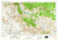
~ Mesa AZ topo map, 1:250000 scale, 1 X 2 Degree, Historical, 1964, updated 1964
Mesa, Arizona, USGS topographic map dated 1964.
Includes geographic coordinates (latitude and longitude). This topographic map is suitable for hiking, camping, and exploring, or framing it as a wall map.
Printed on-demand using high resolution imagery, on heavy weight and acid free paper, or alternatively on a variety of synthetic materials.
Topos available on paper, Waterproof, Poly, or Tyvek. Usually shipping rolled, unless combined with other folded maps in one order.
- Product Number: USGS-5549588
- Free digital map download (high-resolution, GeoPDF): Mesa, Arizona (file size: 22 MB)
- Map Size: please refer to the dimensions of the GeoPDF map above
- Weight (paper map): ca. 55 grams
- Map Type: POD USGS Topographic Map
- Map Series: HTMC
- Map Verison: Historical
- Cell ID: 68907
- Scan ID: 315546
- Imprint Year: 1964
- Woodland Tint: Yes
- Field Check Year: 1954
- Datum: Unstated
- Map Projection: Transverse Mercator
- Map published by United States Geological Survey
- Map Language: English
- Scanner Resolution: 600 dpi
- Map Cell Name: Mesa
- Grid size: 1 X 2 Degree
- Date on map: 1964
- Map Scale: 1:250000
- Geographical region: Arizona, United States
Neighboring Maps:
All neighboring USGS topo maps are available for sale online at a variety of scales.
Spatial coverage:
Topo map Mesa, Arizona, covers the geographical area associated the following places:
- Shiloh Canyon - Cimarron - Sonora Town - Desert Wind - Wagon Wheel Mobile Ranch - Green Acres Trailer Court - Marlborough Mesa - Helena - Rancho Mirage Mobile Home Park - Pacific Mobile Manor - Sierra Estates Mobile Home Park - Cedar Ridge - Meridian Manufactured Home Park - Cinco Soles - Twin Knolls Mobile Home Villa - Carrizo - New Hope Trailer Park - Mesa East Mobile Home Community - Husky Hollow Mobile Home Park - Apache Junction - Fountain of the Sun - Natches - Rose Creek Lodge - Bridgeport - MonDak Mobile Home Park - Olberg - Citrus Gardens - Oakhurst - Lemontree - Garden Spot Mobile Home Park - Hayden Junction - Klahanne Mobile Home Park - Keats Crossing - Rambler Mobile Park - Riviera Mobile Home Park - Lariat Tra-Tel Trailer Court - Mesa Gardens Mobile Home Park - Peridot - Wheel Inn Ranch Mobile Home Park - Mesa Shadows Mobile Home Park - Imperial Mobile Home Park - Estados de La Mancha II - Rancho Santa Fe - Silvergate Trails - Rancho de Arboleda - Las Alegres - Parkside - Palm Springs - Higley - Buenavante - Globe Mobile Home Park - Casa Serena Mobile Home Park - Alma Gardens - Rio Verde - Mesa Shadows East Mobile Home Park - Velda Rose Estates - Amberwood - Bear Canyon Junction - Cherokee Mobile Village - Montecito Mobile Home Estates - Sonora - Lehi - Shady Ranch Trailer Lodge - Paradise Palms Trailer Resorts - Gold Canyon - Cactus Wren Mobile Park - Pinnacle Peak Estates II - Brentwood West - Coronado Mobile Home Park - Parkview Village Mobile Home and Recreational Vehicle Park - Pueblo Grande Mobile Home Park - Orangetree - Citrus Grove Trailer Court - Camp Creek - Roadhaven Recreational Vehicle Resort - Woodleaf II - Roosevelt Lake Gardens East - Twin Knolls - Los Maderas - Hawaiian Village Mobile Home Park - Prado del Sol - Cimmaron Trails Mobile Home Park - Reata Pass - Breezeway Trailer Park - Punkin Center - Palmas Del Sol Mobile Home Park - Sunflower - Silver Spur Ranch Mobile Home Park - Estates La Colina - Dimario Place - Willow - M and M Mobile Village - Lamplighter Mobile Village - Ahwatukee - Horseshoe Mobile Home Park - Pinnacle Peak Country Club Estates - Queen Creek - Royal Palm Village Mobile Home Park - Trails West Mobile Home Park - Ray
- Map Area ID: AREA3433-112-110
- Northwest corner Lat/Long code: USGSNW34-112
- Northeast corner Lat/Long code: USGSNE34-110
- Southwest corner Lat/Long code: USGSSW33-112
- Southeast corner Lat/Long code: USGSSE33-110
- Northern map edge Latitude: 34
- Southern map edge Latitude: 33
- Western map edge Longitude: -112
- Eastern map edge Longitude: -110


