
~ Douglas AZ topo map, 1:250000 scale, 1 X 2 Degree, Historical, 1961, updated 1961
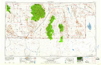
Douglas, Arizona, USGS topographic map dated 1961.
Includes geographic coordinates (latitude and longitude). This topographic map is suitable for hiking, camping, and exploring, or framing it as a wall map.
Printed on-demand using high resolution imagery, on heavy weight and acid free paper, or alternatively on a variety of synthetic materials.
Topos available on paper, Waterproof, Poly, or Tyvek. Usually shipping rolled, unless combined with other folded maps in one order.
- Product Number: USGS-5549506
- Free digital map download (high-resolution, GeoPDF): Douglas, Arizona (file size: 13 MB)
- Map Size: please refer to the dimensions of the GeoPDF map above
- Weight (paper map): ca. 55 grams
- Map Type: POD USGS Topographic Map
- Map Series: HTMC
- Map Verison: Historical
- Cell ID: 68753
- Scan ID: 315466
- Imprint Year: 1961
- Woodland Tint: Yes
- Datum: Unstated
- Map Projection: Transverse Mercator
- Map published by United States Geological Survey
- Map published by United States Army Corps of Engineers
- Map published by United States Army
- Map Language: English
- Scanner Resolution: 600 dpi
- Map Cell Name: Douglas
- Grid size: 1 X 2 Degree
- Date on map: 1961
- Map Scale: 1:250000
- Geographical region: Arizona, United States
Neighboring Maps:
All neighboring USGS topo maps are available for sale online at a variety of scales.
Spatial coverage:
Topo map Douglas, Arizona, covers the geographical area associated the following places:
- Animas - Deer - Birchfield - Sieling's Mobile Village - McNeal - Chiricahua - Bisbee - Jim Robinson - Gibson Place - Calumet - Yarbrough Place - Garcia - Saginaw - Old Hachita - McFarlands - Galeyville - Joe Yarbrough - Black Diamond - Cloverdale - Gleeson - Huachuca Terrace - Upper Lovett Place - Paradise - Warren - Naco - White Place - Upshaw Place - Arizona Sun Sites - Bernardino (historical) - Playas - Lowell - Minero - Mace - Windmill - Briggs - Middle Wells - Old Isaacs Place - Paul Spur - Double Adobe - Corner Ranch - Bramlett - Tintown - Eaton Place - Highland Park - Bene Dunagan - Deer Creek Wells - Sunspots South Mobile Home Park - Rileys El Encinar - Pearce - Lovett - Portal - Douglas - Pothook - Antelope Wells - Lower Lovett Place - Rodeo - Spears - Grizzles Orchard - Pirtleville - Rock Cabin - Forrest - Bisbee Junction - Alamo Hueco - Elfrida - South Bisbee - Antelope - Sunizona - High Lonesome Wells - Mouser Place - Corta Junction - Hachita - Vista - Apache - Courtland - Eakins - Cazador - Abe Yarbrough - Bakerville - Galena - Neff - Mount Vista Mobile Home Park - Pierce - Don Luis - Double Adobes - Hilltop
- Map Area ID: AREA3231-110-108
- Northwest corner Lat/Long code: USGSNW32-110
- Northeast corner Lat/Long code: USGSNE32-108
- Southwest corner Lat/Long code: USGSSW31-110
- Southeast corner Lat/Long code: USGSSE31-108
- Northern map edge Latitude: 32
- Southern map edge Latitude: 31
- Western map edge Longitude: -110
- Eastern map edge Longitude: -108


